Image:Normans possessions 12century-fr.png
Un article de Wikipédia, l'encyclopédie libre.
Taille de cet aperçu : 800 × 582 pixels
Image en plus haute résolution (1 400 × 1 018 pixels, taille du fichier : 1,13 Mio, type MIME : image/png)
| | Ce fichier provient de Wikimedia Commons?. Les informations le concernant sont affichées ci-dessous (procédure). |
[edit] Summary
| Description |
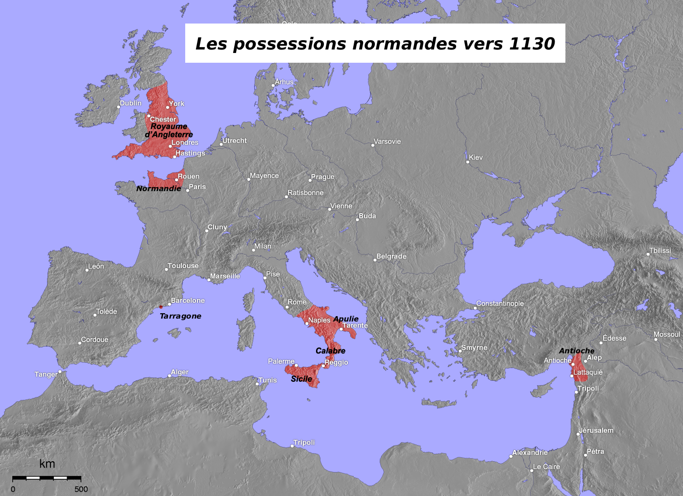
Map in French of the Normans possessions in the 12th century |
|---|---|
| Source |
Image:Normannen.png created by de:Captain Blood (originally taken from the German Wikipedia) |
| Date |
April 2005 (original) – August 2006 (translation) |
| Author |
Original map : de:Captain Blood |
| Permission (Reusing this image) |
GFDL |
| Other versions | Original German version : Image:Normannen.png |
Français :
- Sujet : Carte en français des possessions normandes au XIIe siècle ;
- Source : Image:Normannen.png créée par de:Captain Blood (originellement issue de la Wikipédia germanophone) ;
- Autres versions disponibles :
-
- germanophone : Image:Normannen.png ;
- Auteurs :
-
- carte originale : de:Captain Blood ;
- traduction : Eric Gaba (fr:Sting) ;
- Dates :
-
- originale : Avril 2005 ;
- traduction : Août 2006.
English: This map was made or improved by the Wikigraphists of the Atelier graphique. You can propose maps or images to clean up and improve as well.
Esperanto: Ĉi tiu mapo estis kreita aŭ plibonigita de la Vikigrafistoj el la Grafika laborgrupo. Vi ankaŭ povas tie proponi mapojn aŭ bildojn plibonigendajn.
Español: Este mapa ha sido confeccionado o mejorado por los Wikígrafos del Taller gráfico. Puedes proponer la mejora de cualquier imagen a través de la página de Peticiones.
Français : Cette carte a été créée ou améliorée par les Wikigraphistes de l'Atelier graphique. Vous pouvez également y proposer des cartes ou des images à améliorer.
Türkçe: Bu harita Atelier graphique'ten Wikigraphistes'ler tarafından yapıldı veya geliştirildi. Siz de haritalar veya resimleri temizlemek veya geliştirmek için teklif edebilirsiniz.
[edit] Licensing
 |
Permission is granted to copy, distribute and/or modify this map under the terms of the GNU Free Documentation License, Version 1.2 or any later version published by the Free Software Foundation; with no Invariant Sections, no Front-Cover Texts, and no Back-Cover Texts. A copy of the license is included in the section entitled "GNU Free Documentation License". The map has been created with the Generic Mapping Tools: http://gmt.soest.hawaii.edu/ using one or more of these public domain datasets for the relief:
|
|
Historique du fichier
Cliquer sur une date et une heure pour voir le fichier tel qu’il était à ce moment-là
| Date et heure | Dimensions | Utilisateur | Commentaire | |
|---|---|---|---|---|
| actuel | 30 août 2006 à 20:50 | 1 400×1 018 (1,13 Mio) | Sting | ({{Information |Description=Map in French of the Normans possessions in the 12th century |Source=Image:Normannen.png created by de:Captain Blood (originally taken from the German Wikipedia) |Date=April 2005 (original) �) |
Pages contenant l’image
Les pages ci-dessous contiennent cette image :

