Image:Vulcano bransfield-strait hg.png
Un article de Wikipédia, l'encyclopédie libre.
Taille de cet aperçu : 800 × 537 pixels
Image en plus haute résolution (3 132 × 2 104 pixels, taille du fichier : 934 Kio, type MIME : image/png)
| | Ce fichier provient de Wikimedia Commons?. Les informations le concernant sont affichées ci-dessous (procédure). |
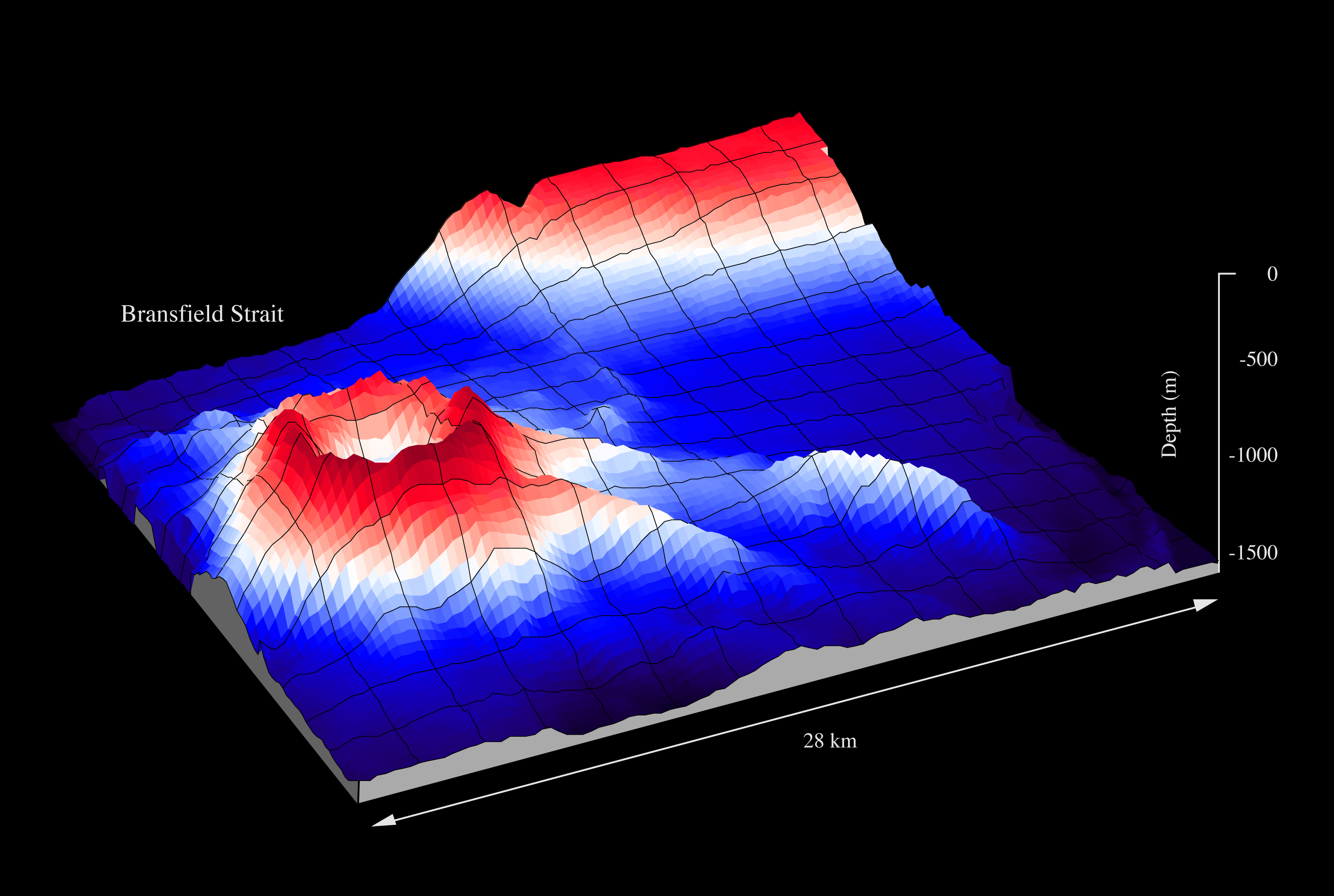
| Description |
Orca Seamount in the Bransfield Strait, Antarctic Peninsula |
|---|---|
| Source |
graf own work - data Fred Niederjasper, AWI, mapped with the swath sonar system of RV POLARSTERN during cruise ANT-XI/3 |
| Date |
1994 |
| Author |
Hannes Grobe, Alfred Wegener Institute for Polar and Marine Research |
| Permission (Reusing this image) |
Own work, share alike, attribution required (Creative Commons CC-BY-SA-2.5) |
| Other versions | published by Hatzky (2005) DOI:10.1594/PANGAEA.341126 |
|
Historique du fichier
Cliquer sur une date et une heure pour voir le fichier tel qu’il était à ce moment-là
| Date et heure | Dimensions | Utilisateur | Commentaire | |
|---|---|---|---|---|
| actuel | 23 juin 2007 à 11:32 | 3 132×2 104 (934 Kio) | Hgrobe | ({{Information |Description=to be defined |Source=own work |Date=2007-06-20 |Author=~~~~, Alfred Wegener Institute for Polar and Marine Research, Bremerhaven, Germany |Permission=Own work, share alike, attribution required (Creative Commons CC-BY-SA-2.5) |) |
Pages contenant l’image
La page ci-dessous contient cette image :

