Image:Tsunami travel time Valdivia 1960.jpg
Un article de Wikipédia, l'encyclopédie libre.
Taille de cet aperçu : 644 × 600 pixels
Image en plus haute résolution (859 × 800 pixels, taille du fichier : 324 Kio, type MIME : image/jpeg)
| | Ce fichier provient de Wikimedia Commons?. Les informations le concernant sont affichées ci-dessous (procédure). |
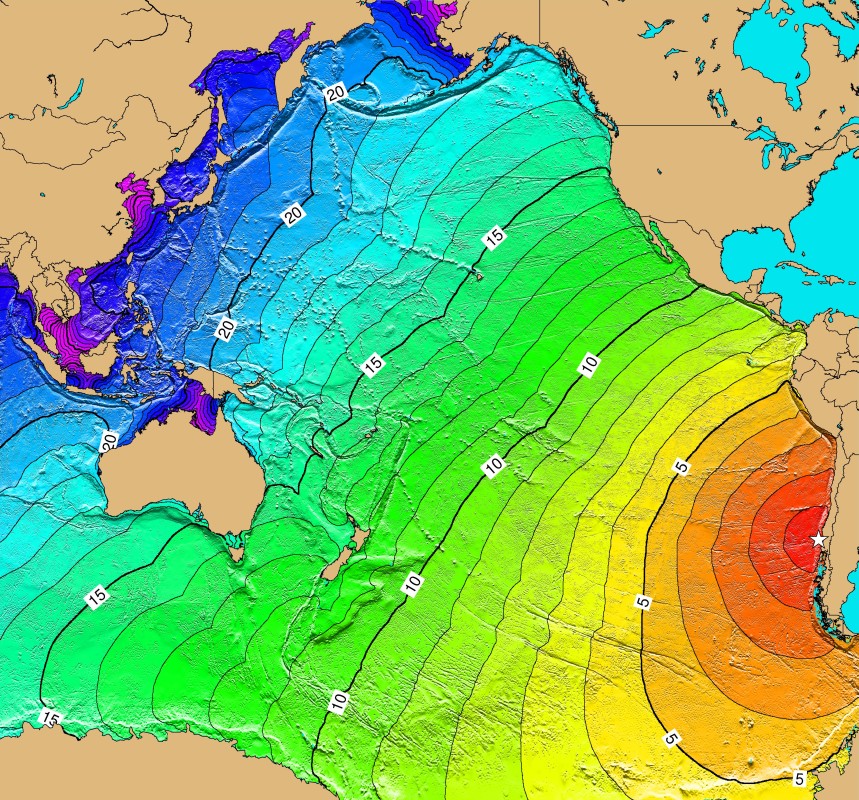
Español: Mapa con el avance del tsunami del terremoto de Valdivia, Chile, 22 de mayo de 1960
English: Tsunami-Travel-Time of the earthquake of Valdivia, Chile, May 22, 1960. Contours are one hour intervals.
[edit] Licensing
| This image is in the public domain because it contains materials that originally came from the U.S. National Oceanic and Atmospheric Administration, taken or made during the course of an employee's official duties. |
|
Historique du fichier
Cliquer sur une date et une heure pour voir le fichier tel qu’il était à ce moment-là
| Date et heure | Dimensions | Utilisateur | Commentaire | |
|---|---|---|---|---|
| actuel | 11 mars 2006 à 03:18 | 859×800 (324 Kio) | B1mbo | ({{es|Mapa con el avance del tsunami del terremoto de Valdivia, 22 de mayo de 1960}} '''Source:''' [http://www.ngdc.noaa.gov/seg/hazard/img/1960_0522.jpg NGDC Tsunami-Travel-Time Maps] Category:Chile Category:Tsunamis ==Licensing== {{PD-USGov-NO) |
Pages contenant l’image
La page ci-dessous contient cette image :

