Image:South Shetland Islands Map.png
Un article de Wikipédia, l'encyclopédie libre.
Taille de cet aperçu : 800 × 551 pixels
Image en plus haute résolution (1 103 × 760 pixels, taille du fichier : 35 Kio, type MIME : image/png)
| | Ce fichier provient de Wikimedia Commons?. Les informations le concernant sont affichées ci-dessous (procédure). |
| Description |
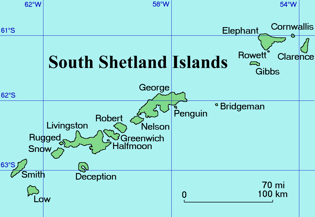
Map of the South Shetland Islands Català: Mapa de les illes Shetland del Sud.
Deutsch: Karte der Südlichen Shetlandinseln
Español: Mapa de las Islas Shetland del Sur
Italiano: Una mappa delle Isole Shetland Meridionali
Русский: Карта Южных Шетландских островов (английский вариант)
Slovenščina: Zemljevid otočja
|
|---|---|
| Source |
Originally from en.wikipedia; description page is (was) here
|
| Date |
Commons upload by Snowdog |
| Author |
User Topbanana on en.wikipedia |
| Permission (Reusing this image) |
PD-self |
| This image has been (or is hereby) released into the public domain by its author, Topbanana at the English Wikipedia project. This applies worldwide. In case this is not legally possible: |
Historique du fichier
Cliquer sur une date et une heure pour voir le fichier tel qu’il était à ce moment-là
| Date et heure | Dimensions | Utilisateur | Commentaire | |
|---|---|---|---|---|
| actuel | 27 février 2005 à 22:11 | 1 103×760 (35 Kio) | Snowdog | (Map of the South Shetland Islands) |
Pages contenant l’image
Les pages ci-dessous contiennent cette image :

