Image:Provinces of Tuscany map.png
Un article de Wikipédia, l'encyclopédie libre.
Taille de cet aperçu : 780 × 600 pixels
Image en plus haute résolution (1 000 × 769 pixels, taille du fichier : 211 Kio, type MIME : image/png)
| | Ce fichier provient de Wikimedia Commons?. Les informations le concernant sont affichées ci-dessous (procédure). |
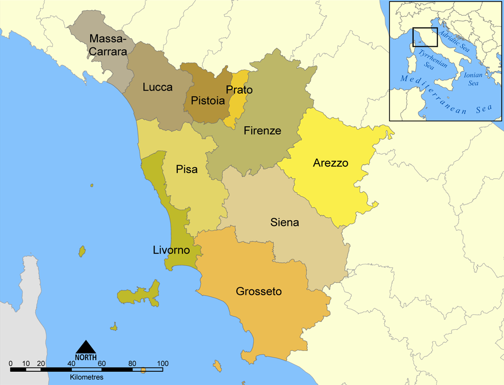
This map shows the provinces of the Italian region of Tuscany.
Created by NormanEinstein, August 26, 2005.

Historique du fichier
Cliquer sur une date et une heure pour voir le fichier tel qu’il était à ce moment-là
| Date et heure | Dimensions | Utilisateur | Commentaire | |
|---|---|---|---|---|
| actuel | 8 avril 2006 à 21:34 | 1 000×769 (211 Kio) | Pitichinaccio | (corrected spelling of Pistoia (was Pistoria)) |
| 26 août 2005 à 22:57 | 1 000×769 (276 Kio) | NormanEinstein | (This map shows the provinces of the Italian region of Tuscany. Created by NormanEinstein, August 26, 2005. {{GFDL-self}} Category: Maps of Italy) |
Pages contenant l’image
Les pages ci-dessous contiennent cette image :

