Image:NWCoast1a.png
Un article de Wikipédia, l'encyclopédie libre.

Pas de plus haute résolution disponible.
NWCoast1a.png (761 × 529 pixels, taille du fichier : 172 Kio, type MIME : image/png)
| | Ce fichier provient de Wikimedia Commons?. Les informations le concernant sont affichées ci-dessous (procédure). |
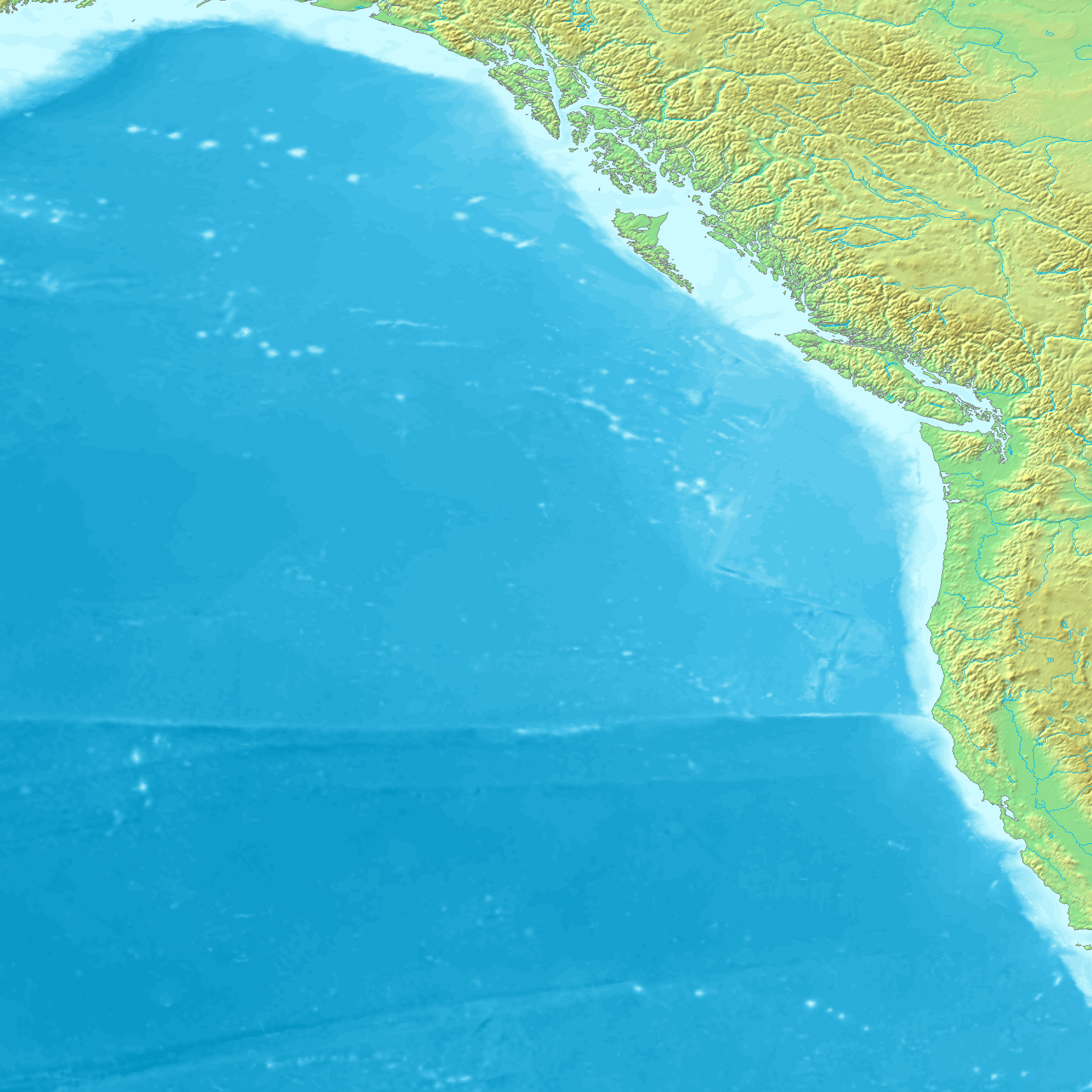
| Description |
Map of the coast of the Pacific Northwest --- Islands and major straits of the northern American pacific coast showing Prince of Wales Island (Alaska), Queen Charlotte Sound (Canada), Dixon Entrance, Hecate Strait, Baranof Island, Chichagof Island, Juneau Icefield, Stikine Icecap and other |
|---|---|
| Source |
http://en.wikipedia.org/wiki/Image:NWCoast1a.png — — — This is adapted from a regional Topographic map made from GEMS data that is already posted on Wikimedia Commons. Original map created from DEMIS Mapserver, which are public domain. |
| Date | |
| Author | |
| Permission (Reusing this image) |
|

Historique du fichier
Cliquer sur une date et une heure pour voir le fichier tel qu’il était à ce moment-là
| Date et heure | Dimensions | Utilisateur | Commentaire | |
|---|---|---|---|---|
| actuel | 1 septembre 2006 à 13:24 | 761×529 (172 Kio) | Mattes | ({{Information |Description=Map of the coast of the Pacific Northwest --- Islands and major straits of the northern American pacific coast showing Prince of Wales Island (Alaska), Queen Charlotte Sound (Canada), Dixon Entrance, Hecate Strait, Baranof Isla) |
Pages contenant l’image
Les pages ci-dessous contiennent cette image :

