Image:Nabta-Egypt NL.jpg
Un article de Wikipédia, l'encyclopédie libre.
Taille de cet aperçu : 562 × 600 pixels
Image en plus haute résolution (1 190 × 1 270 pixels, taille du fichier : 660 Kio, type MIME : image/jpeg)
| | Ce fichier provient de Wikimedia Commons?. Les informations le concernant sont affichées ci-dessous (procédure). |
[edit] Summary
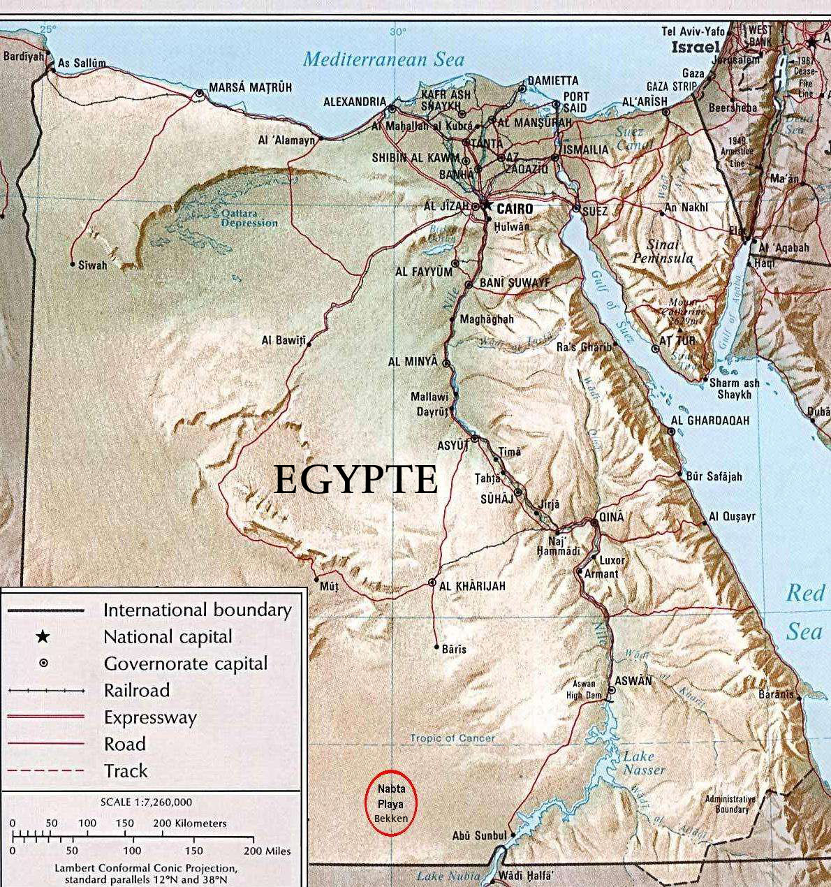
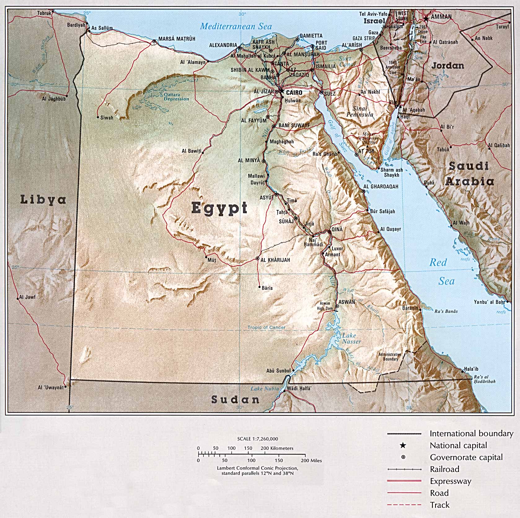
Dutch version of Public Domain Map, permission granted here, by the University of Texas at Austin.
Source: Map from The University of Texas at Austin: Egypt: Country Map.
Map reduced in size, and "Legend" and "Scale" moved up, to conserve space. Also approximate position of Nabta Playa noted: Latitude 22° 32' 00" North; Longitude 30° 42' 00" East. Subsequently translated to Dutch from the aforementioned source from English Wikipedia.
[edit] Licensing
| This work is in the public domain in the United States because it is a work of the United States Federal Government under the terms of Title 17, Chapter 1, Section 105 of the US Code. See Copyright.
Note: This only applies to works of the Federal Government and not to the work of any individual U.S. state, territory, commonwealth, county, municipality, or any other subdivision. العربية | Български | Česky | Deutsch | English | Español | Français | Magyar | Italiano | 日本語 | 한국어 | Polski | Português | 中文(繁體) | 中文(简体) | +/- |
 |
Historique du fichier
Cliquer sur une date et une heure pour voir le fichier tel qu’il était à ce moment-là
| Date et heure | Dimensions | Utilisateur | Commentaire | |
|---|---|---|---|---|
| actuel | 25 juin 2006 à 13:38 | 1 190×1 270 (660 Kio) | Thor NL | (== Summary == Dutch version of Public Domain Map, permission granted [http://www.lib.utexas.edu/usage_statement.html?maps=yes ''here''], by the University of Texas at Austin. Source: [http://www.lib.utexas.edu/maps/atlas_middle_east/egypt.jpg Map] from [) |
Pages contenant l’image
La page ci-dessous contient cette image :
Métadonnées
Ce fichier contient des informations supplémentaires probablement ajoutées par l’appareil photo numérique ou le numériseur qui l’a acquis. Si le fichier a été modifié depuis son état original, certains détails peuvent ne pas refléter entièrement l’image modifiée.
| Orientation | Normale |
|---|---|
| Résolution horizontale | 72 dpi |
| Résolution verticale | 72 dpi |
| Logiciel utilisé | Adobe Photoshop CS2 Windows |
| Date de modification | 25 juin 2006 à 12:58 |
| Espace colorimétrique | 65535 |

