Image:Mer de Glace sketchmap by John Tyndall, 1857, from 1896 edition.png
Un article de Wikipédia, l'encyclopédie libre.
Taille de cet aperçu : 800 × 486 pixels
Image en plus haute résolution (1 544 × 938 pixels, taille du fichier : 724 Kio, type MIME : image/png)
| | Ce fichier provient de Wikimedia Commons?. Les informations le concernant sont affichées ci-dessous (procédure). |
| Description |
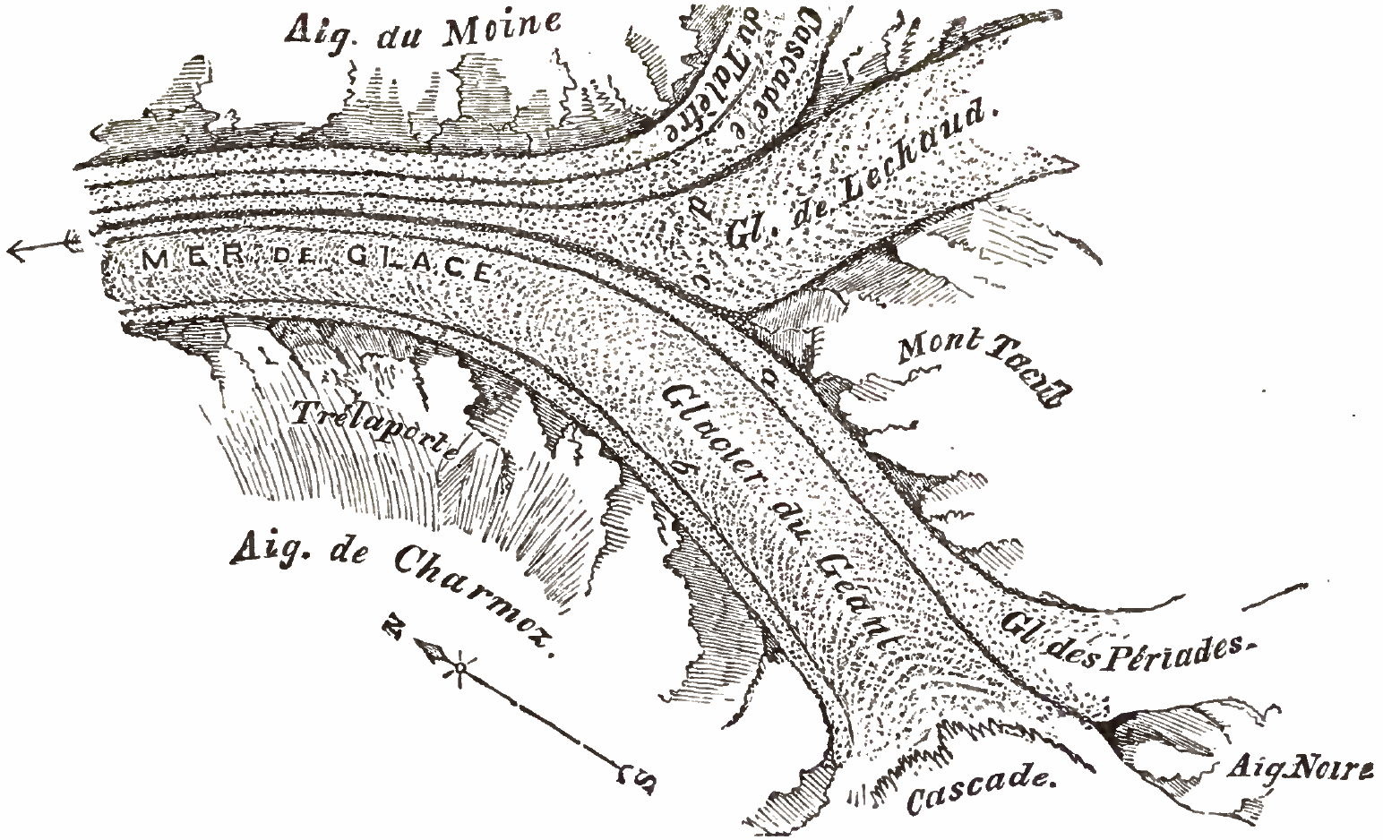
Mer de Glace sketchmap by John Tyndall, 1857 Fig. 7[1] shows Aiguille Noire to the south (bottom-right) dividing the Cascade at the west (bottom) from Glacier des Périades (right) which flows north to join Glacier du Géant flowing south to north (14 degrees clockwise) between Mont Tacul on the east (centre right) and Aiguilles de Charmoz to the west (bottom alongside morraine 'b'). This forms the medial morraine 'a'. Some 3 kilometres downstream, Glacier de Lechaud joins du Géant, forming medial morraine 'c'. Just prior to this confluence, Cascade du Talèfre, with its own medial morraine 'e', joins Lechaud forming morraine 'd'. Here the glacier is known as the Mer De Glace and flows north-north-west (leftwards) between Aiguille du Moine on the east and Trélaporte on the west. Notes
References
|
||
|---|---|---|---|
| Source |
PDF from http://www.archive.org/details/glaciersalpsbeing00tyndrich or alternative: http://books.google.it/books?id=8_cN1DQ3mZ4C&printsec=frontcover&hl=en#PPA53,M1 |
||
| Date |
1896 |
||
| Author |
John Tyndall (1820-1893) |
||
| Permission (Reusing this image) |
|
Historique du fichier
Cliquer sur une date et une heure pour voir le fichier tel qu’il était à ce moment-là
| Date et heure | Dimensions | Utilisateur | Commentaire | |
|---|---|---|---|---|
| actuel | 29 février 2008 à 20:36 | 1 544×938 (724 Kio) | Wikibob | ({{Information |Description=Mer de Glace sketchmap by John Tyndall, 1857 Fig. 7<ref>Tyndall page 53 "Fig 7."</ref> shows Aiguille Noire to the south (bottom-right) dividing the Cascade at the west (bottom) from Glacier des Périades (right) which flows no) |
Pages contenant l’image
Les pages ci-dessous contiennent cette image :

