Image:Light hair coloration map.png
Un article de Wikipédia, l'encyclopédie libre.
Pas de plus haute résolution disponible.
Light_hair_coloration_map.png (648 × 519 pixels, taille du fichier : 6 Kio, type MIME : image/png)
| | Ce fichier provient de Wikimedia Commons?. Les informations le concernant sont affichées ci-dessous (procédure). |
- copied from English Wikipedia
[edit] Summary
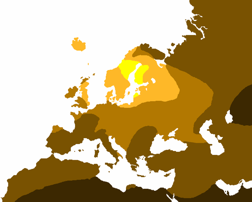
This is a derivative work from a free-use map I found on Wikipedia link. I recolored it. It is a recreation of anthropologist Robert Frost's study on light hair color . The yellow represents 80%+ light hair, light orange is 50-79% light hair, light brown is 20-49% light hair, dark brown is 1-19% light hair, and black represents no presence of light hair in the indigenous population outside of random mutations such as albinoism. I plan to use it in a template where I will label these percentages.--DarkTea 20:47, 9 December 2006 (UTC)
[edit] Licensing

Historique du fichier
Cliquer sur une date et une heure pour voir le fichier tel qu’il était à ce moment-là
| Date et heure | Dimensions | Utilisateur | Commentaire | |
|---|---|---|---|---|
| actuel | 21 avril 2008 à 16:57 | 648×519 (6 Kio) | NordNordWest | |
| 21 avril 2008 à 16:42 | 648×519 (6 Kio) | NordNordWest | ({{Information |Description= |Source= |Date= |Author=Titus Groan (corrected version) |Permission= |other_versions= }}) | |
| 21 février 2007 à 22:43 | 648×519 (40 Kio) | Tuohirulla | (:''copied from English Wikipedia'' == Summary == This is a derivative work from a free-use map I found on Wikipedia [http://en.wikipedia.org/wiki/Image:Map_of_Europe_%28political%29.png link]. I recolored it. It is a recreation of anthropologist Robert ) |
Pages contenant l’image
Les pages ci-dessous contiennent cette image :

