Image:Departments of Uruguay (map).png
Un article de Wikipédia, l'encyclopédie libre.
Pas de plus haute résolution disponible.
Departments_of_Uruguay_(map).png (450 × 436 pixels, taille du fichier : 26 Kio, type MIME : image/png)
| | Ce fichier provient de Wikimedia Commons?. Les informations le concernant sont affichées ci-dessous (procédure). |
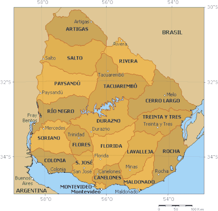
- Description : Political map of Uruguay
- Author : Enciclopedia Libre
Original map generate with the aplication Online Map Creation, Martin Weinelt (GMT)

Historique du fichier
Cliquer sur une date et une heure pour voir le fichier tel qu’il était à ce moment-là
| Date et heure | Dimensions | Utilisateur | Commentaire | |
|---|---|---|---|---|
| actuel | 18 septembre 2005 à 11:47 | 450×436 (26 Kio) | Tvpm | |
| 4 avril 2005 à 18:23 | 450×436 (106 Kio) | David Legrand | (* '''Description''' : Political map of Uruguay * '''Author''' : [http://enciclopedia.us.es/index.php/Imagen:Mapa_pol%EDtico_de_Uruguay.png Enciclopedia Libre]<br /> Original map generate with the aplication [http://www.aquarius.geomar.de/omc_intro.html On) |
Pages contenant l’image
Les pages ci-dessous contiennent cette image :


.png)