Image:British isles 802.jpg
Un article de Wikipédia, l'encyclopédie libre.
Taille de cet aperçu : 572 × 599 pixels
Image en plus haute résolution (1 076 × 1 127 pixels, taille du fichier : 1,19 Mio, type MIME : image/jpeg)
| | Ce fichier provient de Wikimedia Commons?. Les informations le concernant sont affichées ci-dessous (procédure). |
[edit] Summary
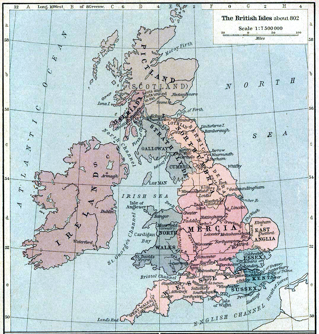
Map of the isle Great Britain in the year 802. Image comes from the University of Texas at Austin: http://www.lib.utexas.edu/maps/historical/history%5Feurope.html
Map is released into the public Domain.
Increased saturation, contrast and sharpness to fix ageing/scanning. Steinsky 18:37, 8 October 2006 (UTC)
Dublin didn't exist in 802, and Ireland wasn't united. More important centres would be Tara and Emain Macha. 86.42.216.137 11:23, 27 August 2007 (UTC)
[edit] Licensing
| This image (or other media file) is in the public domain because its copyright has expired. This applies to the United States, Canada, the European Union and those countries with a copyright term of life of the author plus 70 years.
العربية | Asturianu | Български | Català | Česky | Dansk | Deutsch | English | Ελληνικά | Esperanto | Español | Euskara | فارسی | Français | Gaeilge | Galego | עברית | हिन्दी | Bahasa Indonesia | Italiano | 日本語 | 한국어 | Kurdî / كوردی | Lietuvių | Magyar | Nederlands | Norsk (nynorsk) | Македонски | Bahasa Melayu | Polski | Português | Română | Русский | Slovenčina | Slovenščina | Shqip | Suomi | Sámegiella | Türkçe | 中文(简体) | 中文(繁體) | 粵語 | +/- |
Historique du fichier
Cliquer sur une date et une heure pour voir le fichier tel qu’il était à ce moment-là
| Date et heure | Dimensions | Utilisateur | Commentaire | |
|---|---|---|---|---|
| actuel | 8 octobre 2006 à 20:36 | 1 076×1 127 (1,19 Mio) | Steinsky | (cleaned) |
| 3 décembre 2005 à 17:47 | 1 076×1 127 (273 Kio) | Migdejong | (Map of the isle Great Brittain in the year 802. Image comes from the University of Texas at Austin: http://geography.about.com/gi/dynamic/offsite.htm?site=http://www.lib.utexas.edu/maps/historical/history%5Feurope.html Map is released into the publi) |
Pages contenant l’image
Les pages ci-dessous contiennent cette image :

