Image:Beaufort Sea and disputed waters cropped.png
Un article de Wikipédia, l'encyclopédie libre.
Pas de plus haute résolution disponible.
Beaufort_Sea_and_disputed_waters_cropped.png (509 × 456 pixels, taille du fichier : 122 Kio, type MIME : image/png)
| | Ce fichier provient de Wikimedia Commons?. Les informations le concernant sont affichées ci-dessous (procédure). |
| Description |
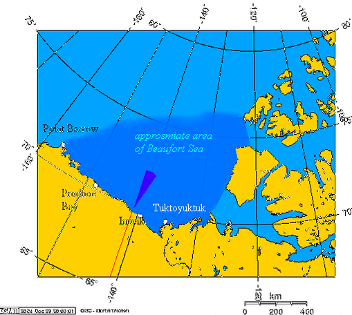
This is a cropped version of Image:Beaufort_Sea_and_disputed_waters.png. Español: Área aproximada del Mar de Beaufort, y el área en disputa
Beaufort Sea and the disputed waters The wedge shaped area on this map is the approximate area of the waters in dispute between the Yukon and Alaska. The longitude and latitudes of the communities follow:
|
||
|---|---|---|---|
| Source | |||
| Date | |||
| Author | |||
| Permission (Reusing this image) |
|
||
| Other versions | Image:Beaufort_Sea_and_disputed_waters.png |

Historique du fichier
Cliquer sur une date et une heure pour voir le fichier tel qu’il était à ce moment-là
| Date et heure | Dimensions | Utilisateur | Commentaire | |
|---|---|---|---|---|
| actuel | 26 août 2007 à 19:11 | 509×456 (122 Kio) | Reaper X | ({{Information |Description='''This is a cropped version of Image:Beaufort_Sea_and_disputed_waters.png.''' {{es|Área aproximada del Mar de Beaufort, y el área en disputa}} Beaufort Sea and the disputed waters The wedge shaped area on this map is ) |
Pages contenant l’image
La page ci-dessous contient cette image :

