Image:AfricanUnion-map.png
Un article de Wikipédia, l'encyclopédie libre.
Pas de plus haute résolution disponible.
AfricanUnion-map.png (354 × 405 pixels, taille du fichier : 12 Kio, type MIME : image/png)
| | Ce fichier provient de Wikimedia Commons?. Les informations le concernant sont affichées ci-dessous (procédure). |
 A vector version of this image (SVG) is available. For more information about vector graphics, read about Commons transition to SVG. Български | Deutsch | English | Español | Français | Galego | עברית | Magyar | Bahasa Indonesia | Italiano | 日本語 | 한국어 | Lietuvių | Polski | Português | Русский | Српски / Srpski | Українська | 中文(简体) | 中文(繁體) | +/- |
 |
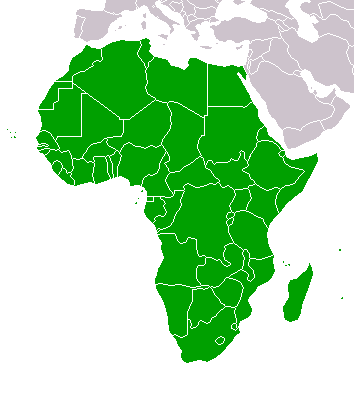
[edit] Description
Map of the member states of the African Union.
From : Wikipedia english => [1]
[edit] Original upload history
- 18:36, September 19, 2005 . . E Pluribus Anthony (Talk) . . 354x405 (8340 bytes) (Map: African Union (2005))
- 08:43, September 18, 2005 . . E Pluribus Anthony (Talk) . . 354x405 (8332 bytes) (African Union)
- 08:28, September 18, 2005 . . E Pluribus Anthony (Talk) . . 354x405 (8338 bytes) (African Union)
- 20:52, October 13, 2004 . . Sverdrup (Talk) . . 360x392 (4574 bytes) (New version)
- 10:20, August 15, 2004 . . Aris Katsaris (Talk) . . 300x343 (4777 bytes) (too bright color)
- 06:51, August 15, 2004 . . Sverdrup (Talk) . . 300x343 (3106 bytes) (Map of the member states of the African Union. Derived from Image:BlankMap-World.png. {{GFDL}})
[edit] Licensing
 |
Permission is granted to copy, distribute and/or modify this document under the terms of the GNU Free Documentation License, Version 1.2 or any later version published by the Free Software Foundation; with no Invariant Sections, no Front-Cover Texts, and no Back-Cover Texts. Subject to disclaimers. Asturianu | Български | Català | Deutsch | English | Español | Français | Gaeilge | Italiano | 한국어 | 日本語 | Polski | Português | Română | Türkçe | +/- |
Historique du fichier
Cliquer sur une date et une heure pour voir le fichier tel qu’il était à ce moment-là
| Date et heure | Dimensions | Utilisateur | Commentaire | |
|---|---|---|---|---|
| actuel | 18 juin 2008 à 16:35 | 354×405 (12 Kio) | Xiquet | (Reverted to version as of 18:10, 9 May 2008) |
| 17 juin 2008 à 01:02 | 354×405 (12 Kio) | CHV | (Reverted to version as of 03:08, 9 March 2008) | |
| 9 mai 2008 à 20:10 | 354×405 (12 Kio) | Vispec | (Cr) | |
| 9 mars 2008 à 05:08 | 354×405 (12 Kio) | Koavf | (Reverted to version as of :, 0 <> ) | |
| 7 mars 2008 à 22:54 | 354×405 (12 Kio) | Fhamator | (Reverted to version as of 13:10, 31 January 2008) | |
| 28 février 2008 à 15:20 | 354×405 (12 Kio) | Hexagon1 | (WA is a state equal to others within AU so for AU cartography purposes it is a country.) | |
| 31 janvier 2008 à 15:10 | 354×405 (12 Kio) | Fhamator | (Neutrality) | |
| 22 décembre 2007 à 08:18 | 354×405 (12 Kio) | Koavf | (Reverted to version as of 19:24, 21 December 2007) | |
| 22 décembre 2007 à 02:35 | 354×405 (12 Kio) | Dead.one | (Western sahara is a DISPUTED area under MOROCCAN administration, IT'S NOT COUNTRY) | |
| 21 décembre 2007 à 21:24 | 354×405 (12 Kio) | Koavf | (Reverted to version as of 12:12, 21 December 2007) | |
| 21 décembre 2007 à 14:52 | 354×405 (12 Kio) | Ke.Pioneer | (Reverted to version as of 10:59, 21 December 2007) | |
| 21 décembre 2007 à 14:12 | 354×405 (12 Kio) | Koavf | (Reverted to version as of 22:30, 20 December 2007) | |
| 21 décembre 2007 à 12:59 | 354×405 (12 Kio) | Vispec | (Western sahara is a DISPUTED area under MOROCCAN administration, IT'S NOT COUNTRY) | |
| 21 décembre 2007 à 00:30 | 354×405 (12 Kio) | Reisio | (Reverted to version as of 18:59, 4 December 2007) | |
| 4 décembre 2007 à 22:14 | 354×405 (12 Kio) | Vispec | (Western sahara is a DISPUTED area under MOROCCAN administration, IT'S NOT COUNTRY) | |
| 4 décembre 2007 à 20:59 | 354×405 (12 Kio) | Aboyado | (Sahara belongs to AfricanUnion) | |
| 4 décembre 2007 à 13:26 | 354×405 (12 Kio) | Babylone | (Reverted to version as of 01:05, 23 November 2007) | |
| 3 décembre 2007 à 15:57 | 354×405 (12 Kio) | Gandal el gris | (Reverted to version as of 23:21, 1 January 2007) | |
| 23 novembre 2007 à 03:05 | 354×405 (12 Kio) | Vispec | ||
| 2 janvier 2007 à 01:21 | 354×405 (12 Kio) | Hoshie | (Added Cabinda. Under same license as original.) | |
| 19 décembre 2006 à 04:46 | 354×405 (12 Kio) | Hoshie | (Added the AU's newest neighbour...Montenegro! Mod under same license as orginal.) | |
| 20 mars 2006 à 23:39 | 354×405 (8 Kio) | Sanao | (Map of the member states of the African Union.<br /> Frome : [http://en.wikipedia.org/wiki/Image:AfricanUnion-map.png]) |
Pages contenant l’image
La page ci-dessous contient cette image :


![[1]](http://en.wikipedia.org/wiki/Image:AfricanUnion-map.png)