Image:NASA - Visible Earth, Lakes of the African Rift Valley.jpg
Un article de Wikipédia, l'encyclopédie libre.
Taille de cet aperçu : 800 × 523 pixels
Image en plus haute résolution (1 000 × 654 pixels, taille du fichier : 127 Kio, type MIME : image/jpeg)
| | Ce fichier provient de Wikimedia Commons?. Les informations le concernant sont affichées ci-dessous (procédure). |
[edit] Summary
from NASA [1]
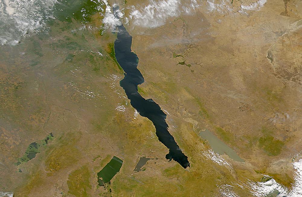
The lakes of the African Rift Valley exhibit wide variations in water color as can be seen in this SeaWiFS image. From left to right the lakes are: Lake Upemba, Lake Mweru, Lake Tanganyika (largest), and Lake Rukwa. This image spans the southeastern corner of the Democratic Republic of the Congo, northeastern Zambia, and southern Tanzania.
[edit] Credit
Provided by the SeaWiFS Project, NASA/Goddard Space Flight Center, and ORBIMAGE
[edit] Licensing
| This image is from the Sea-viewing Wide Field-of-view Sensor (SeaWiFS) Project. Satellite data captured by the SeaWIFS sensor are released into the public domain 5 years after capture.[2] Data less than five years old can be re-used only for educational or scientific purposes; any commercial use of such images must be coordinated with ORBIMAGE/GeoEye. |
Historique du fichier
Cliquer sur une date et une heure pour voir le fichier tel qu’il était à ce moment-là
| Date et heure | Dimensions | Utilisateur | Commentaire | |
|---|---|---|---|---|
| actuel | 25 septembre 2005 à 20:40 | 1 000×654 (127 Kio) | Moyogo | (from NASA [http://visibleearth.nasa.gov/view_rec.php?id=757] Category:Africa) |
Pages contenant l’image
La page ci-dessous contient cette image :

