Image:London Underground Zone 1.png
Un article de Wikipédia, l'encyclopédie libre.
Taille de cet aperçu : 800 × 456 pixels
Image en plus haute résolution (1 280 × 730 pixels, taille du fichier : 98 Kio, type MIME : image/png)
| | Ce fichier provient de Wikimedia Commons?. Les informations le concernant sont affichées ci-dessous (procédure). |
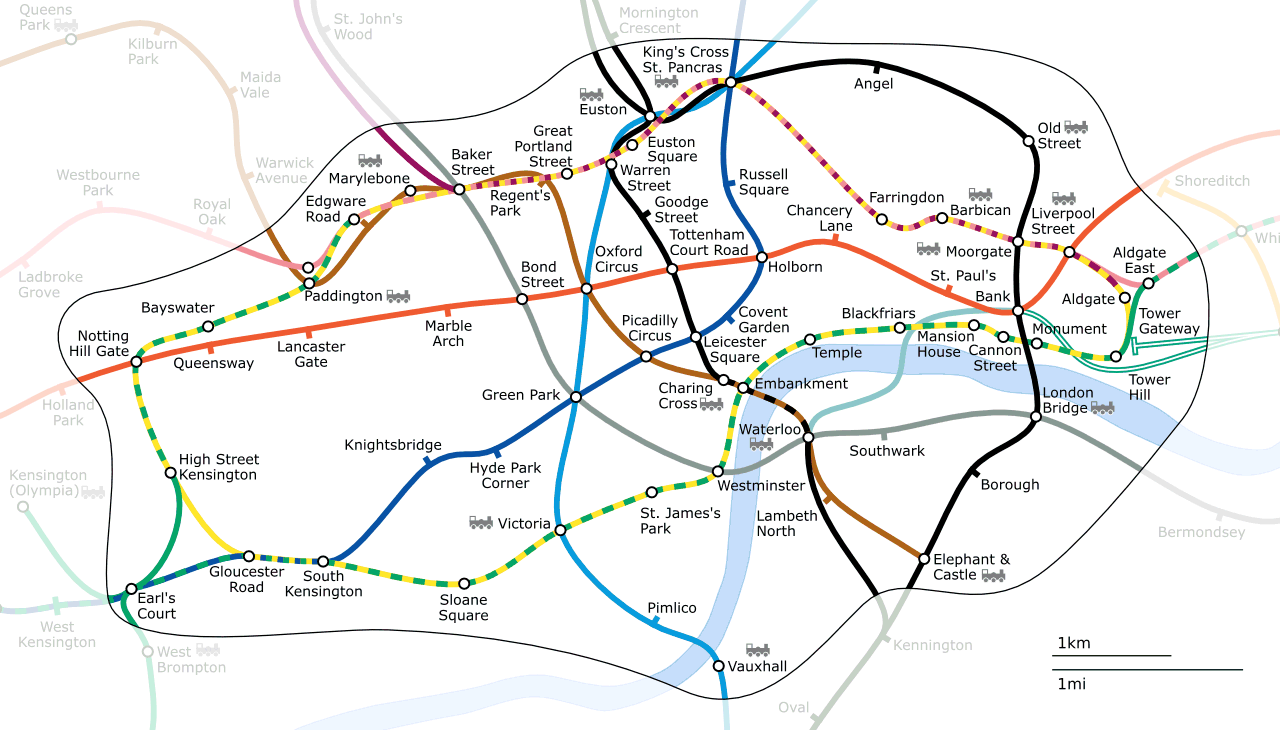
Generated as part of the London Underground geographic maps project by software written by ed g2s • talk and James D. Forrester utilising GPS data.
NB: Routes between stations are interpolated and may not be geographically accurate
- PNG: Image:London Underground Zone 1.png
- SVG: Image:London Underground Zone 1.svg

| This file is licensed under the Creative Commons Attribution ShareAlike license versions 2.5, 2.0, and 1.0
العربية | Български | Català | Česky | Dansk | Deutsch | English | Español | Euskara | فارسی | Français | עברית | Italiano | 日本語 | 한국어 | Lietuvių | Nederlands | Polski | Português | Русский | Svenska | தமிழ் | Türkçe | 中文 | 中文 | +/- |
Historique du fichier
Cliquer sur une date et une heure pour voir le fichier tel qu’il était à ce moment-là
| Date et heure | Dimensions | Utilisateur | Commentaire | |
|---|---|---|---|---|
| actuel | 18 avril 2006 à 19:41 | 1 280×730 (98 Kio) | Ed g2s | |
| 9 septembre 2005 à 21:39 | 1 280×730 (87 Kio) | Ed g2s | (Move Southwark) | |
| 25 juillet 2005 à 18:29 | 1 280×730 (87 Kio) | Ed g2s | (fixes) | |
| 15 juillet 2005 à 03:36 | 1 280×730 (98 Kio) | Ed g2s | ({{London Underground geographic maps}}) |
Pages contenant l’image
Les pages ci-dessous contiennent cette image :

