Image:Zealandia topography.jpg
Un article de Wikipédia, l'encyclopédie libre.
Taille de cet aperçu : 507 × 599 pixels
Image en plus haute résolution (573 × 677 pixels, taille du fichier : 143 Kio, type MIME : image/jpeg)
| | Ce fichier provient de Wikimedia Commons?. Les informations le concernant sont affichées ci-dessous (procédure). |
[edit] Summary
| Description |
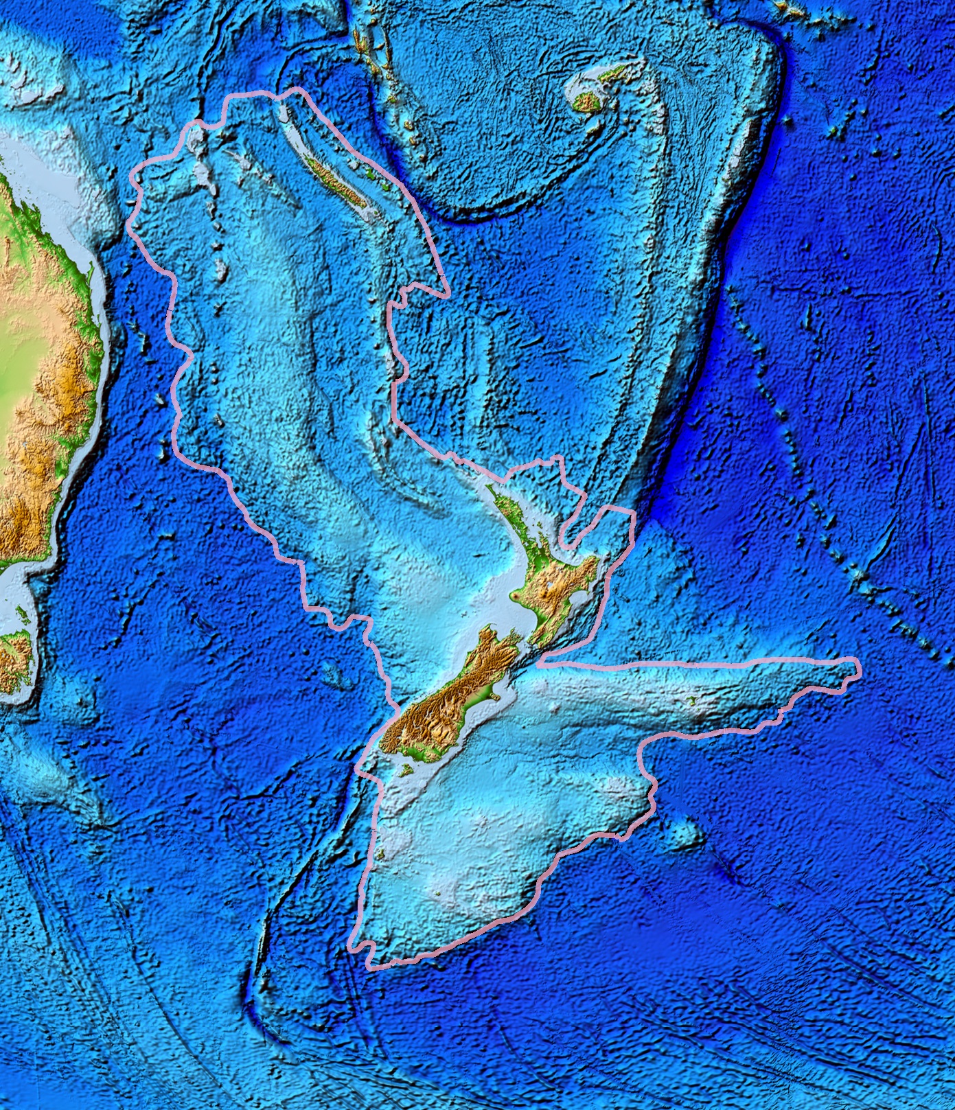
Topographical map of the Zealandia continent. |
|---|---|
| Source |
Ultimate source: ETOPO2v2, a digital database of seafloor and land elevations. Actually cropped from Image:Pacific_elevation.jpg. |
| Date |
June 2006 |
| Author |
World Data Center for Geophysics & Marine Geology (Boulder, CO), National Geophysical Data Center, NOAA |
| Permission (Reusing this image) |
NOAA, public domain |
| Other versions | Image:Pacific_elevation.jpg, here cropped to focus on Zealandia. |
[edit] Licensing
| This image is in the public domain because it contains materials that originally came from the U.S. National Oceanic and Atmospheric Administration, taken or made during the course of an employee's official duties. |
|
Historique du fichier
Cliquer sur une date et une heure pour voir le fichier tel qu’il était à ce moment-là
| Date et heure | Dimensions | Utilisateur | Commentaire | |
|---|---|---|---|---|
| actuel | 13 mars 2007 à 03:44 | 573×677 (143 Kio) | Avenue | (== Summary == {{Information |Description=Topographical map of the Zealandia continent. |Source=Source: [http://www.ngdc.noaa.gov/mgg/image/2minrelief.html]. Actually cropped from Image:Pacific_elevation.jpg. |Date=June 2006 |Permissio) |
Pages contenant l’image
Les pages ci-dessous contiennent cette image :

