Image:Yellowstone Caldera map2.jpg
Un article de Wikipédia, l'encyclopédie libre.
Taille de cet aperçu : 743 × 600 pixels
Image en plus haute résolution (3 072 × 2 479 pixels, taille du fichier : 2,42 Mio, type MIME : image/jpeg)
| | Ce fichier provient de Wikimedia Commons?. Les informations le concernant sont affichées ci-dessous (procédure). |
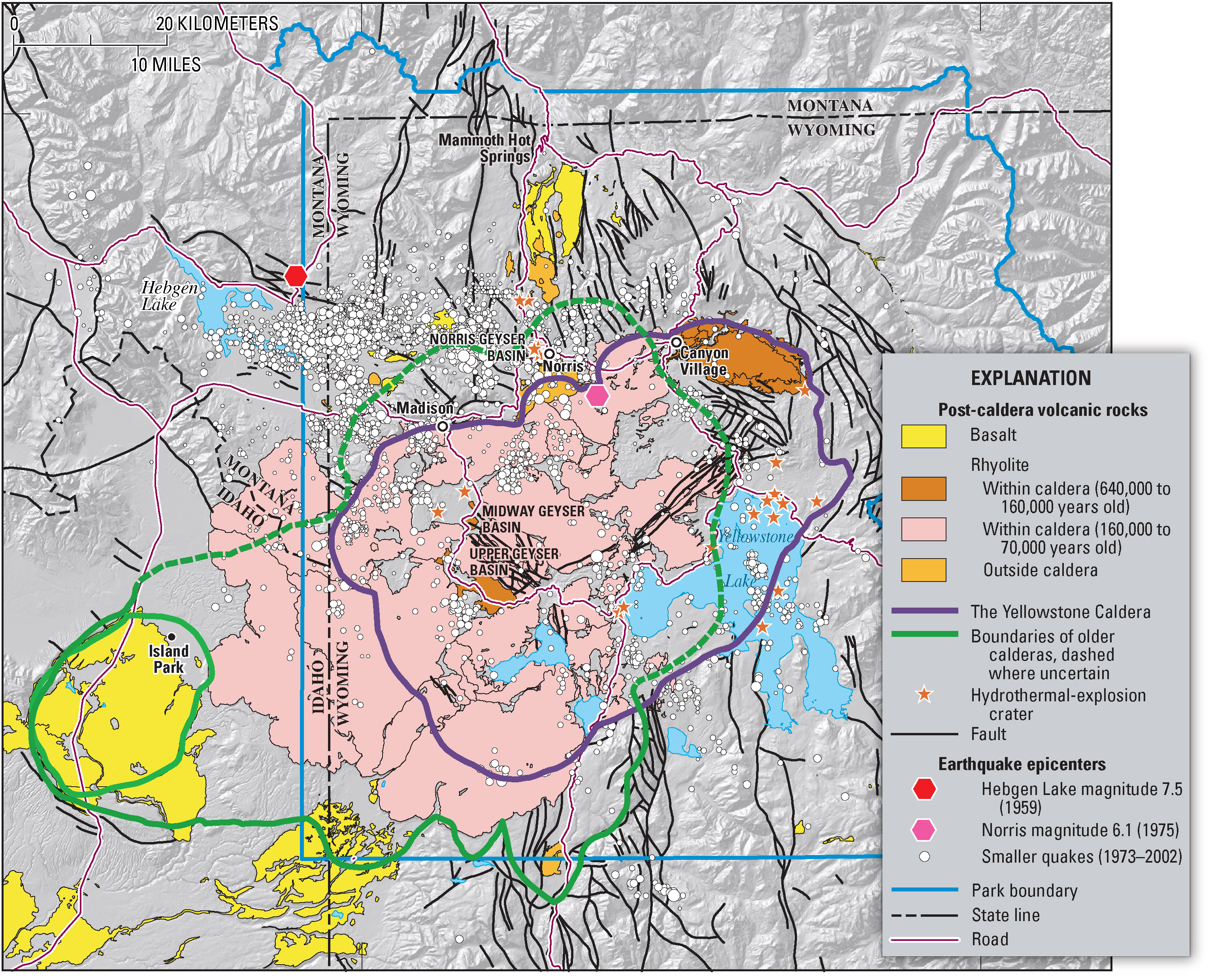
Geologic information regarding Yellowstone Caldera. From USGS. [1]
| This image is in the public domain because it contains materials that originally came from the United States Geological Survey, an agency of the United States Department of Interior. For more information, see the official USGS copyright policy |
|
Historique du fichier
Cliquer sur une date et une heure pour voir le fichier tel qu’il était à ce moment-là
| Date et heure | Dimensions | Utilisateur | Commentaire | |
|---|---|---|---|---|
| actuel | 16 février 2006 à 09:49 | 3 072×2 479 (2,42 Mio) | Napa | (Geologic information regarding Yellowstone Caldera. From USGS. [http://pubs.usgs.gov/fs/2005/3024/press-images/fig_03_yellowstone_map.jpg] {{PD-USGov-Interior-USGS}} Category:Geography of the United States Category:Maps of the United States) |
Pages contenant l’image
Les pages ci-dessous contiennent cette image :
Métadonnées
Ce fichier contient des informations supplémentaires probablement ajoutées par l’appareil photo numérique ou le numériseur qui l’a acquis. Si le fichier a été modifié depuis son état original, certains détails peuvent ne pas refléter entièrement l’image modifiée.
| Orientation | Normale |
|---|---|
| Résolution horizontale | 512 dpi |
| Résolution verticale | 512 dpi |
| Logiciel utilisé | Adobe Photoshop CS Macintosh |
| Date de modification | 14 mars 2005 à 09:51 |
| Espace colorimétrique | sRGB |


![[1]](http://pubs.usgs.gov/fs/2005/3024/press-images/fig_03_yellowstone_map.jpg)