Image:World of Ptolemy as shown by Johannes de Armsshein - Ulm 1482.png
Un article de Wikipédia, l'encyclopédie libre.
Taille de cet aperçu : 800 × 582 pixels
Image en plus haute résolution (1 168 × 849 pixels, taille du fichier : 2,97 Mio, type MIME : image/png)
| | Ce fichier provient de Wikimedia Commons?. Les informations le concernant sont affichées ci-dessous (procédure). |
| Description |
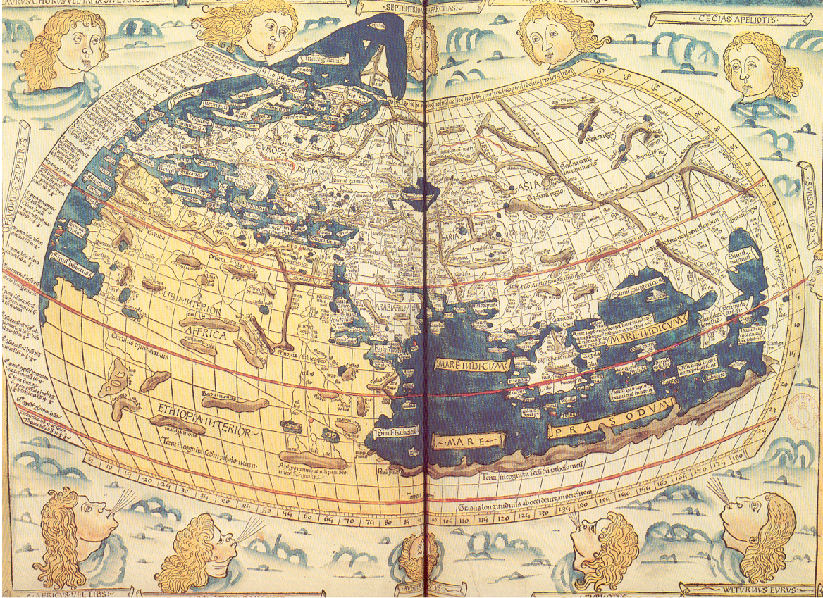
Historical Map of the Old World, as Ptolemy knew it. |
||
|---|---|---|---|
| Source |
Extrait du périscope "La cartographie", éditions PEMF - CANNES |
||
| Date |
Holycharly 12:14, 8 July 2006 (UTC) |
||
| Author | |||
| Permission (Reusing this image) |
Ce document vous est offet par les Publications de l'Ecole moderne française, BP109-06322 CANNES-LA BOCCA CEDEX (sentence refering to the source document itself)
|
||
| Other versions | compare with Kangnido map of the world, 1402 & Map of the world by Fra Mauro, 1459 |
Historique du fichier
Cliquer sur une date et une heure pour voir le fichier tel qu’il était à ce moment-là
| Date et heure | Dimensions | Utilisateur | Commentaire | |
|---|---|---|---|---|
| actuel | 8 juillet 2006 à 16:22 | 1 168×849 (2,97 Mio) | Holycharly | ({{Information |Description= Historical Map of the Old World, as en:Ptolemy knew it.<br/> Backcover description from the scanned document :<br/> :''On ne possède aucune carte de Ptolémée. Celle que nous reproduisons a été gravée sur bois à Ulm) |
Pages contenant l’image
La page ci-dessous contient cette image :

