Image:War of the Pacific LOC map-fr.png
Un article de Wikipédia, l'encyclopédie libre.
Taille de cet aperçu : 392 × 599 pixels
Image en plus haute résolution (1 648 × 2 517 pixels, taille du fichier : 275 Kio, type MIME : image/png)
| | Ce fichier provient de Wikimedia Commons?. Les informations le concernant sont affichées ci-dessous (procédure). |
Translation of Image:War_of_the_Pacific_LOC_map.png by --Kimdime69 23:41, 1 January 2007 (UTC)
[edit] Summary
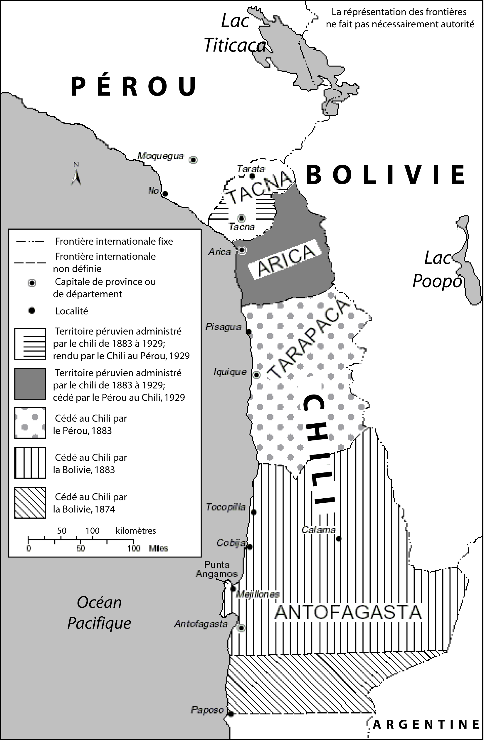
| Description |
en: Map showing changes of territory due to the War of the Pacific |
|---|---|
| Source |
United States Library of Congress Country Studies. This is used as an illustration in the country studies on both Peru and Chile. |
| Date |
1994 |
| Author |
United States Fedreal Government |
| Permission (Reusing this image) |
Public domain |
[edit] Licensing
| This work is in the public domain in the United States because it is a work of the United States Federal Government under the terms of Title 17, Chapter 1, Section 105 of the US Code. See Copyright.
Note: This only applies to works of the Federal Government and not to the work of any individual U.S. state, territory, commonwealth, county, municipality, or any other subdivision. العربية | Български | Česky | Deutsch | English | Español | Français | Magyar | Italiano | 日本語 | 한국어 | Polski | Português | 中文(繁體) | 中文(简体) | +/- |
 |
Historique du fichier
Cliquer sur une date et une heure pour voir le fichier tel qu’il était à ce moment-là
| Date et heure | Dimensions | Utilisateur | Commentaire | |
|---|---|---|---|---|
| actuel | 2 janvier 2007 à 01:39 | 1 648×2 517 (275 Kio) | Kimdime69 | (Translation of Image:War_of_the_Pacific_LOC_map.png) |
Pages contenant l’image
Les pages ci-dessous contiennent cette image :

