Image:TTPI-locatormap.png
Un article de Wikipédia, l'encyclopédie libre.
Pas de plus haute résolution disponible.
TTPI-locatormap.png (330 × 228 pixels, taille du fichier : 14 Kio, type MIME : image/png)
| | Ce fichier provient de Wikimedia Commons?. Les informations le concernant sont affichées ci-dessous (procédure). |
| Description |
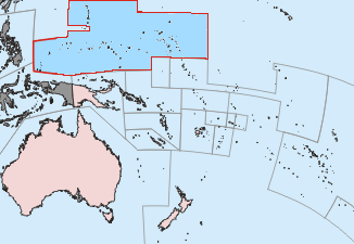
Česky: Mapa poručenského území Tichomořských ostrovů.
English: This is a locator map of the former Trust Territory of the Pacific Islands (TTPI).
|
||
|---|---|---|---|
| Source |
The map is based off of a locator map of Palau found on the German Wiki at de:Bild:Palau-Pos.png; it was created by German Wiki user de:Benutzer:Tzzzpfffand licensed under the GFDL. The changes made from the original map are various. The current boundries of the CNMI, Palau, FSM, and RMI are merged and Guam has it's own boundary due to the fact it never was a part of the TTPI. Boundries have been compared with Image:MapofTTPI.gif for accuracy. As the orginial image was licensed under the GFDL, I place my modification of the orginial map under the GFDL as well. |
||
| Date | |||
| Author |
|
||
| Permission (Reusing this image) |
|


Historique du fichier
Cliquer sur une date et une heure pour voir le fichier tel qu’il était à ce moment-là
| Date et heure | Dimensions | Utilisateur | Commentaire | |
|---|---|---|---|---|
| actuel | 19 novembre 2006 à 16:52 | 330×228 (14 Kio) | Electionworld | (== Summary == This is a locator map of the former Trust Territory of the Pacific Islands (TTPI). The map is based off of a locator map of Palau found on the German Wiki at de:Bild:Palau-Pos.png; it was created by German Wiki user [[:de:Benutzer:T) |
Pages contenant l’image
Les pages ci-dessous contiennent cette image :

