Image:Tehran iran 1947.jpg
Un article de Wikipédia, l'encyclopédie libre.
Taille de cet aperçu : 800 × 573 pixels
Image en plus haute résolution (1 619 × 1 160 pixels, taille du fichier : 537 Kio, type MIME : image/jpeg)
| | Ce fichier provient de Wikimedia Commons?. Les informations le concernant sont affichées ci-dessous (procédure). |
| Description |
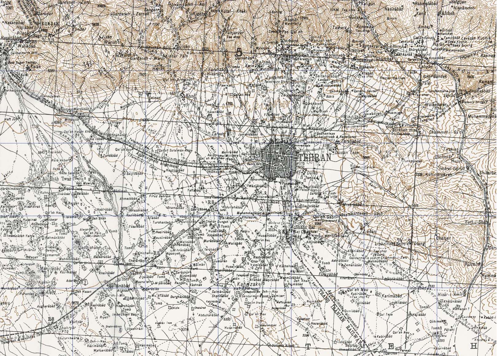
Map of Tehran. Portion of sheet I-39 D Iran. Original scale 1:250,000 Compiled and published originally under the direction of the Surveyor-General of India 1910 and Revised to 1940. Published by the U.S. Army Map Service November, 1947. |
||||
|---|---|---|---|---|---|
| Source |
Perry-Castañeda Library Map Collection, University of Texas [1] |
||||
| Date |
1947 |
||||
| Author | |||||
| Permission (Reusing this image) |
|
||||
Historique du fichier
Cliquer sur une date et une heure pour voir le fichier tel qu’il était à ce moment-là
| Date et heure | Dimensions | Utilisateur | Commentaire | |
|---|---|---|---|---|
| actuel | 8 février 2007 à 13:52 | 1 619×1 160 (537 Kio) | Fabienkhan | ({{Information |Description=Map of Tehran |Source=Perry-Castañeda Library Map Collection, University of Texas [http://www.lib.utexas.edu/maps/historical/tehran_iran_1947.jpg] |Date=1947 |Author= |Permission={{PD-PCL|Tehran_iran_1947.jpg|iran/}} |othe) |
Pages contenant l’image
La page ci-dessous contient cette image :


![[1]](http://www.lib.utexas.edu/maps/historical/tehran_iran_1947.jpg)