Image:Sunda-sahul-wallacea.png
Un article de Wikipédia, l'encyclopédie libre.
Taille de cet aperçu : 662 × 600 pixels
Image en plus haute résolution (800 × 725 pixels, taille du fichier : 53 Kio, type MIME : image/png)
| | Ce fichier provient de Wikimedia Commons?. Les informations le concernant sont affichées ci-dessous (procédure). |
[edit] Description
| Description |
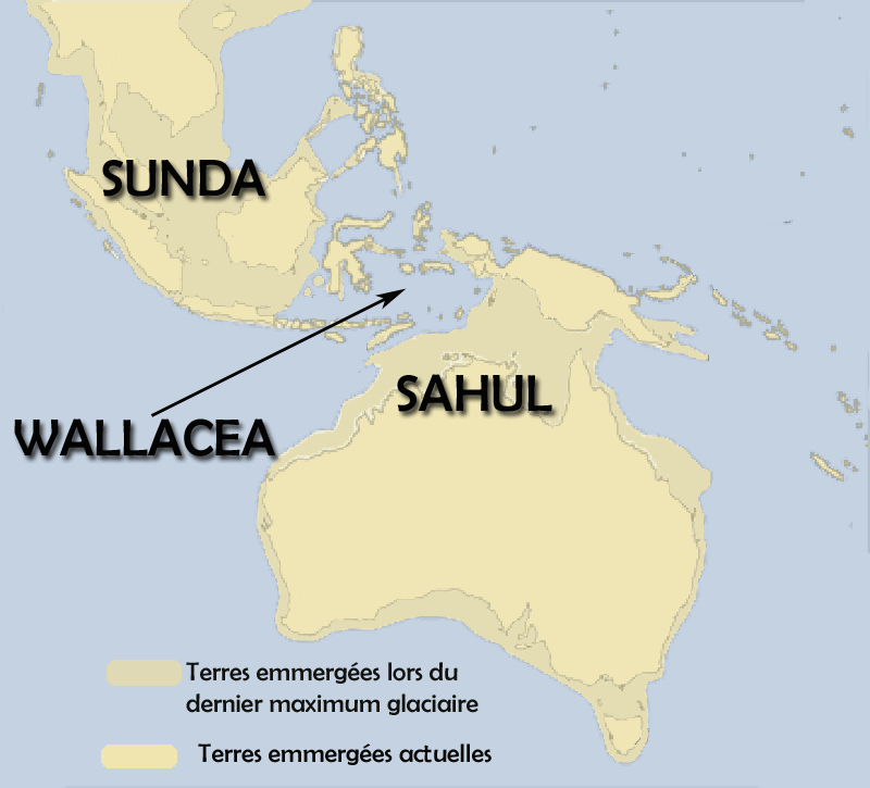
Français :
Le sahul est la bande de terre emmergée lors du dernier maximum glaciaire, quand la mer était 100 m plus basse qu'aujourd'hui, et qui reliait en une masse unique la nouvelle guinnée, l'Australie et la Tasmanie.Le Sunda regroupait la malaisie et l'ouest de l'actuelle Indonésie. Le Wallacea était la mer qui les séparait. English:
Sahul (Tasmania+Australia+New-Guinea) when the sea was 100 metres under the present level. |
|---|---|
| Source |
travail personnel |
| Date | |
| Author | |
| Permission (Reusing this image) |
see below |
[edit] Licensing

Historique du fichier
Cliquer sur une date et une heure pour voir le fichier tel qu’il était à ce moment-là
| Date et heure | Dimensions | Utilisateur | Commentaire | |
|---|---|---|---|---|
| actuel | 30 mars 2008 à 19:06 | 800×725 (53 Kio) | Christophe cagé | ({{Information |Description={{fr}}Le sahul est la bande de terre emmergée lors du dernier maximum glaciaire, quand la mer était 100 m plus basse qu'aujourd'hui, et qui reliait en une masse unique la nouvelle guinnée, l'Australie et la Tasmanie. <br />Le) |
Pages contenant l’image
Les pages ci-dessous contiennent cette image :

