Image:Stfrancisrivermap.png
Un article de Wikipédia, l'encyclopédie libre.
Taille de cet aperçu : 400 × 599 pixels
Image en plus haute résolution (500 × 749 pixels, taille du fichier : 222 Kio, type MIME : image/png)
| | Ce fichier provient de Wikimedia Commons?. Les informations le concernant sont affichées ci-dessous (procédure). |
| Description |
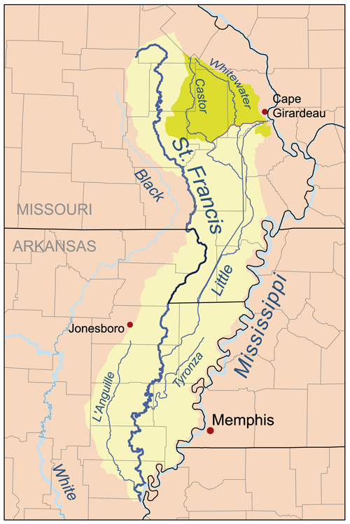
Map of the St. Francis River watershed. The Castor/Whitewater basin (darker shade on the map) was historically part of the St. Francis basin but is now diverted to the Mississippi. |
|---|---|
| Source |
Self-made, based on USGS data. |
| Date |
August 6, 2007 |
| Author | |
| Permission (Reusing this image) |
see below |
|
Historique du fichier
Cliquer sur une date et une heure pour voir le fichier tel qu’il était à ce moment-là
| Date et heure | Dimensions | Utilisateur | Commentaire | |
|---|---|---|---|---|
| actuel | 6 août 2007 à 19:57 | 500×749 (222 Kio) | Kmusser | ({{Information |Description=Map of the St. Francis River watershed. The Castor/Whitewater basin (darker shade on the map) was historically part of the St. Francis basin but is now diverted to the Mississippi. |Source=Self-made, ) |
Pages contenant l’image
Les pages ci-dessous contiennent cette image :

