Image:Stanford-linear-accelerator-usgs-ortho-kaminski-5900.jpg
Un article de Wikipédia, l'encyclopédie libre.
Taille de cet aperçu : 800 × 201 pixels
Image en plus haute résolution (5 900 × 1 480 pixels, taille du fichier : 1,88 Mio, type MIME : image/jpeg)
| | Ce fichier provient de Wikimedia Commons?. Les informations le concernant sont affichées ci-dessous (procédure). |
[edit] Summary
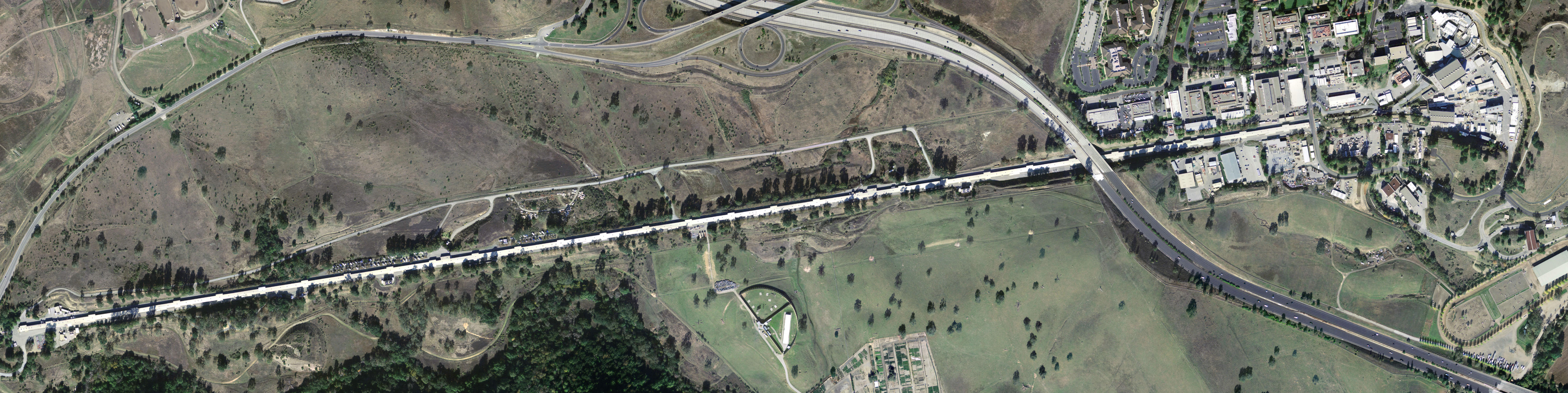
| Description |
Stanford Linear Accelerator, shown in an aerial digital orthoimage. The two roads seen near the accelerator are California Interstate 280 (to the East) and Sand Hill Road (along the Northwest). |
|---|---|
| Source |
United States Geological Survey |
| Date |
February 27, 2004 |
| Author | |
| Permission (Reusing this image) |
see below |
[edit] License
| This image is in the public domain because it contains materials that originally came from the United States Geological Survey, an agency of the United States Department of Interior. For more information, see the official USGS copyright policy |
|
Historique du fichier
Cliquer sur une date et une heure pour voir le fichier tel qu’il était à ce moment-là
| Date et heure | Dimensions | Utilisateur | Commentaire | |
|---|---|---|---|---|
| actuel | 8 mai 2005 à 09:56 | 5 900×1 480 (1,88 Mio) | Floriang | (Stanford Linear Accelerator, shown in an aerial digital orthoimage. Image data acquired 2004-02-27 by the United States Geological Survey. This image created by Peter Kaminski, 2004-12-19 and uploaded in the public domain. {{) |
Pages contenant l’image
La page ci-dessous contient cette image :

