Image:Significant tornado alley.gif
Un article de Wikipédia, l'encyclopédie libre.
Pas de plus haute résolution disponible.
Significant_tornado_alley.gif (512 × 360 pixels, taille du fichier : 8 Kio, type MIME : image/gif)
| | Ce fichier provient de Wikimedia Commons?. Les informations le concernant sont affichées ci-dessous (procédure). |
| Description |
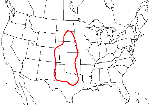
A map of the united states with Tornado Alley outlined, here defined as the area where approximately 1 day or greater per decade contained a significant tornado. |
|||
|---|---|---|---|---|
| Source | ||||
| Date | ||||
| Author | ||||
| Permission (Reusing this image) |
|
Historique du fichier
Cliquer sur une date et une heure pour voir le fichier tel qu’il était à ce moment-là
| Date et heure | Dimensions | Utilisateur | Commentaire | |
|---|---|---|---|---|
| actuel | 20 octobre 2006 à 09:23 | 512×360 (8 Kio) | Runningonbrains | ({{Information |Description=A map of the united states with Tornado Alley outlined, here defined as the area where approximately 1 day or greater per decade contained a significant tornado. |Source=http://www.nssl.noaa.gov) |
Pages contenant l’image
La page ci-dessous contient cette image :

