Image:Sierra de guadarrama-satelite1.JPG
Un article de Wikipédia, l'encyclopédie libre.
Taille de cet aperçu : 789 × 600 pixels
Image en plus haute résolution (1 250 × 950 pixels, taille du fichier : 255 Kio, type MIME : image/jpeg)
| | Ce fichier provient de Wikimedia Commons?. Les informations le concernant sont affichées ci-dessous (procédure). |
[edit] Sumario
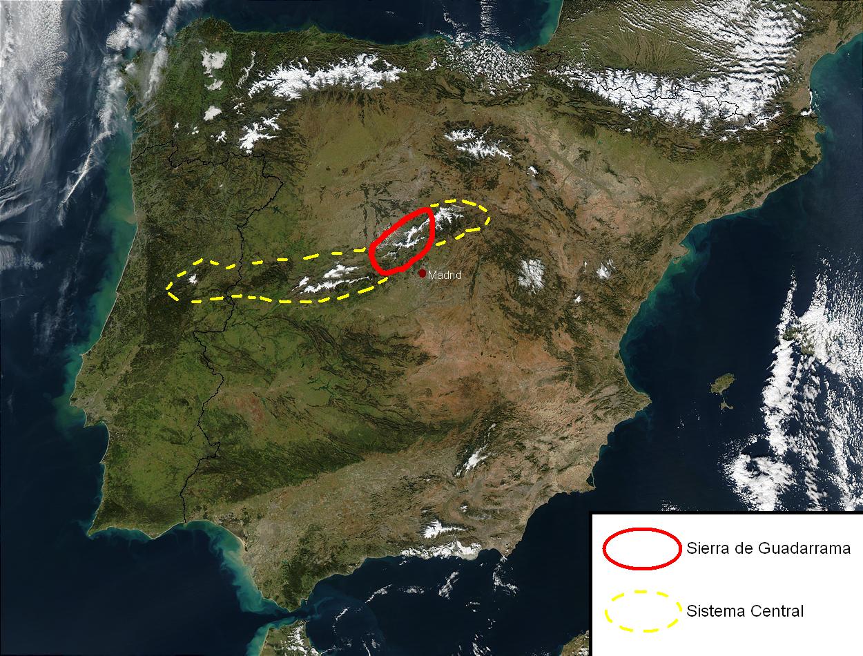
Satellite map of the Sierra de Guadarrama Modified from Image:Satellite image of Spain in January 2003.jpg
[edit] Licensing
|
|
This file is in the public domain because it was created by NASA. NASA copyright policy states that "NASA material is not protected by copyright unless noted". (NASA copyright policy page or JPL Image Use Policy).
Deutsch | English | Español | Français | Nederlands | Português | Русский | 中文(简体) | 中文(繁體) | +/- |
|
 |
Warnings:
|
Historique du fichier
Cliquer sur une date et une heure pour voir le fichier tel qu’il était à ce moment-là
| Date et heure | Dimensions | Utilisateur | Commentaire | |
|---|---|---|---|---|
| actuel | 17 janvier 2008 à 01:19 | 1 250×950 (255 Kio) | Miguel303xm | ({{Information |Description= |Source= |Date= |Author= |Permission= |other_versions= }} ) |
| 15 janvier 2008 à 21:23 | 1 250×950 (272 Kio) | Miguel303xm | ({{Information |Description= |Source= |Date= |Author= |Permission= |other_versions= }} ) | |
| 15 janvier 2008 à 13:40 | 1 461×1 228 (404 Kio) | Miguel303xm | ({{Information |Description= |Source= |Date= |Author= |Permission= |other_versions= }} ) | |
| 23 avril 2006 à 14:45 | 1 462×1 228 (328 Kio) | Miguel303xm | (Satellite map of the Sierra de Guadarrama Image from [http://commons.wikimedia.org/wiki/Image:Satellite_image_of_Spain_in_January_2003.jpg Wikimedia Commons] Category:Comunidad de Madrid) |
Pages contenant l’image
La page ci-dessous contient cette image :

