Image:Sanandreas.jpg
Un article de Wikipédia, l'encyclopédie libre.
Pas de plus haute résolution disponible.
Sanandreas.jpg (362 × 500 pixels, taille du fichier : 50 Kio, type MIME : image/jpeg)
| | Ce fichier provient de Wikimedia Commons?. Les informations le concernant sont affichées ci-dessous (procédure). |
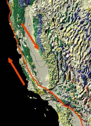
[edit] Summary
| Description |
USGS diagram of San Andreas Fault |
|---|---|
| Source |
http://nationalatlas.gov/articles/geology/features/sanandreas.html |
| Date |
March 14, 2006 |
| Author |
Kate Barton, David Howell, and Joe Vigil |
| Permission (Reusing this image) |
USGS PD work |
[edit] Licensing
| This image is in the public domain because it contains materials that originally came from the United States Geological Survey, an agency of the United States Department of Interior. For more information, see the official USGS copyright policy |
|
Historique du fichier
Cliquer sur une date et une heure pour voir le fichier tel qu’il était à ce moment-là
| Date et heure | Dimensions | Utilisateur | Commentaire | |
|---|---|---|---|---|
| actuel | 7 novembre 2006 à 07:46 | 362×500 (50 Kio) | Hike395 | ({{Information |Description=USGS diagram of San Andreas Fault |Source=http://nationalatlas.gov/articles/geology/features/sanandreas.html |Date=March 14, 2006 |Permission=USGS PD work }}) |
Pages contenant l’image
La page ci-dessous contient cette image :

