Image:Sahara dust plume Nov 1998.jpg
Un article de Wikipédia, l'encyclopédie libre.
Taille de cet aperçu : 800 × 567 pixels
Image en plus haute résolution (4 449 × 3 156 pixels, taille du fichier : 5,06 Mio, type MIME : image/jpeg)
| | Ce fichier provient de Wikimedia Commons?. Les informations le concernant sont affichées ci-dessous (procédure). |
| Description |
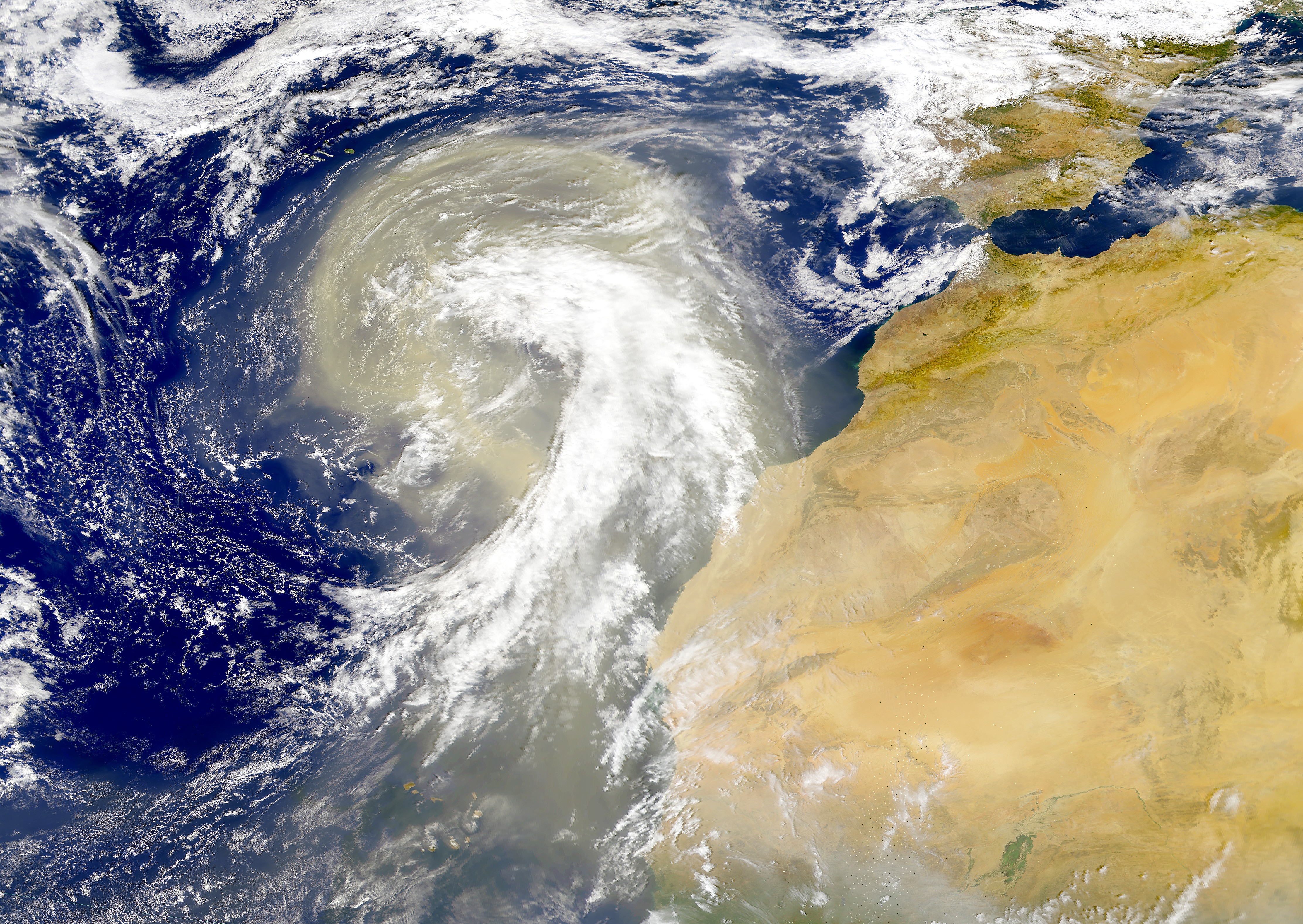
Dust plume off the Sahara desert over the northeast Atlantic Ocean. The Azores are visible at the northwest edge of the dust plume in this SeaWiFS image. The Cape Verde Islands can be seen through the dust near the bottom of the image. Sensor: OrbView-2/SeaWiFS |
|---|---|
| Source | |
| Date |
01 November 1998 |
| Author |
Provided by the SeaWiFS Project, NASA/Goddard Space Flight Center, and ORBIMAGE |
| Permission (Reusing this image) |
see below |
[edit] Licensing
| This image is from the Sea-viewing Wide Field-of-view Sensor (SeaWiFS) Project. Satellite data captured by the SeaWIFS sensor are released into the public domain 5 years after capture.[1] Data less than five years old can be re-used only for educational or scientific purposes; any commercial use of such images must be coordinated with ORBIMAGE/GeoEye. |
Historique du fichier
Cliquer sur une date et une heure pour voir le fichier tel qu’il était à ce moment-là
| Date et heure | Dimensions | Utilisateur | Commentaire | |
|---|---|---|---|---|
| actuel | 6 novembre 2005 à 02:01 | 4 449×3 156 (5,06 Mio) | Tintazul | ({{Information| |Description=Dust plume off the Sahara desert over the northeast Atlantic Ocean. The Azores are visible at the northwest edge of the dust plume in this SeaWiFS image. The Cape Verde Islands can be seen through the dust near the bottom of th) |
Pages contenant l’image
Les pages ci-dessous contiennent cette image :

