Image:Rendsburg-map.png
Un article de Wikipédia, l'encyclopédie libre.
Taille de cet aperçu : 794 × 600 pixels
Image en plus haute résolution (1 694 × 1 280 pixels, taille du fichier : 128 Kio, type MIME : image/png)
| | Ce fichier provient de Wikimedia Commons?. Les informations le concernant sont affichées ci-dessous (procédure). |
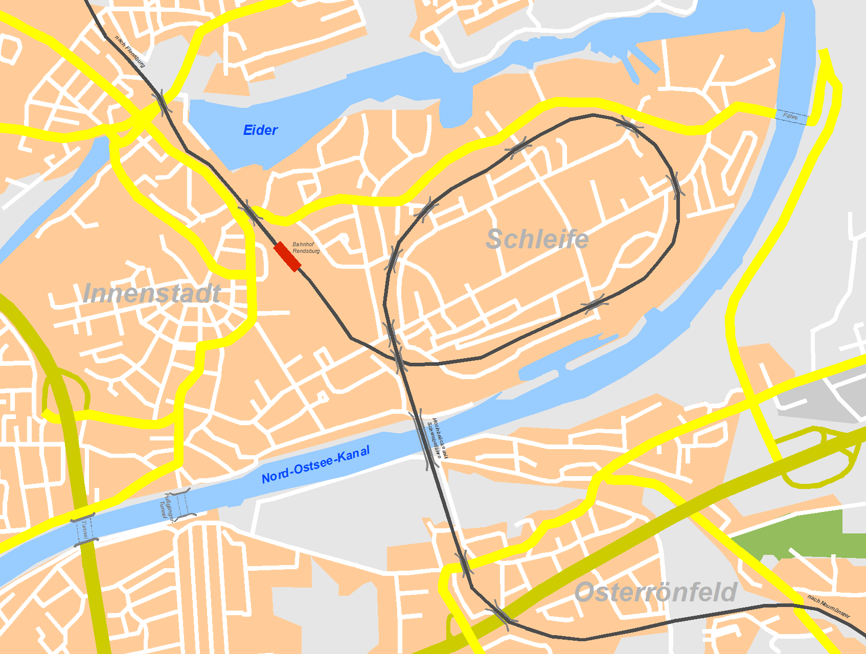
[edit] Beschreibung
| Description |
Karte von Rendsburg mit schematischer Darstellung der Bahnlinie und der Kanalquerungen |
|---|---|
| Source |
selbst erstellt/own work |
| Date |
05.06.2007 |
| Author |
Inselmann |
| Permission (Reusing this image) |
see below |
[edit] Licensing

Historique du fichier
Cliquer sur une date et une heure pour voir le fichier tel qu’il était à ce moment-là
| Date et heure | Dimensions | Utilisateur | Commentaire | |
|---|---|---|---|---|
| actuel | 5 juin 2007 à 19:55 | 1 694×1 280 (128 Kio) | Inselmann | |
| 5 juin 2007 à 18:38 | 1 718×1 288 (130 Kio) | Inselmann | ||
| 5 juin 2007 à 15:41 | 1 712×1 290 (187 Kio) | Inselmann | ({{Information |Description=Karte von Rendsburg mit schematischer Darstellung der Bahnlinie und der Kanalquerungen |Source=selbst erstellt/own work |Date=05.06.2007 |Author=Inselmann }} ) |
Pages contenant l’image
La page ci-dessous contient cette image :

