Image:Planisphæri cœleste.jpg
Un article de Wikipédia, l'encyclopédie libre.
Taille de cet aperçu : 800 × 548 pixels
Image en plus haute résolution (1 804 × 1 236 pixels, taille du fichier : 3,09 Mio, type MIME : image/jpeg)
| | Ce fichier provient de Wikimedia Commons?. Les informations le concernant sont affichées ci-dessous (procédure). |
[edit] Description
| Description |
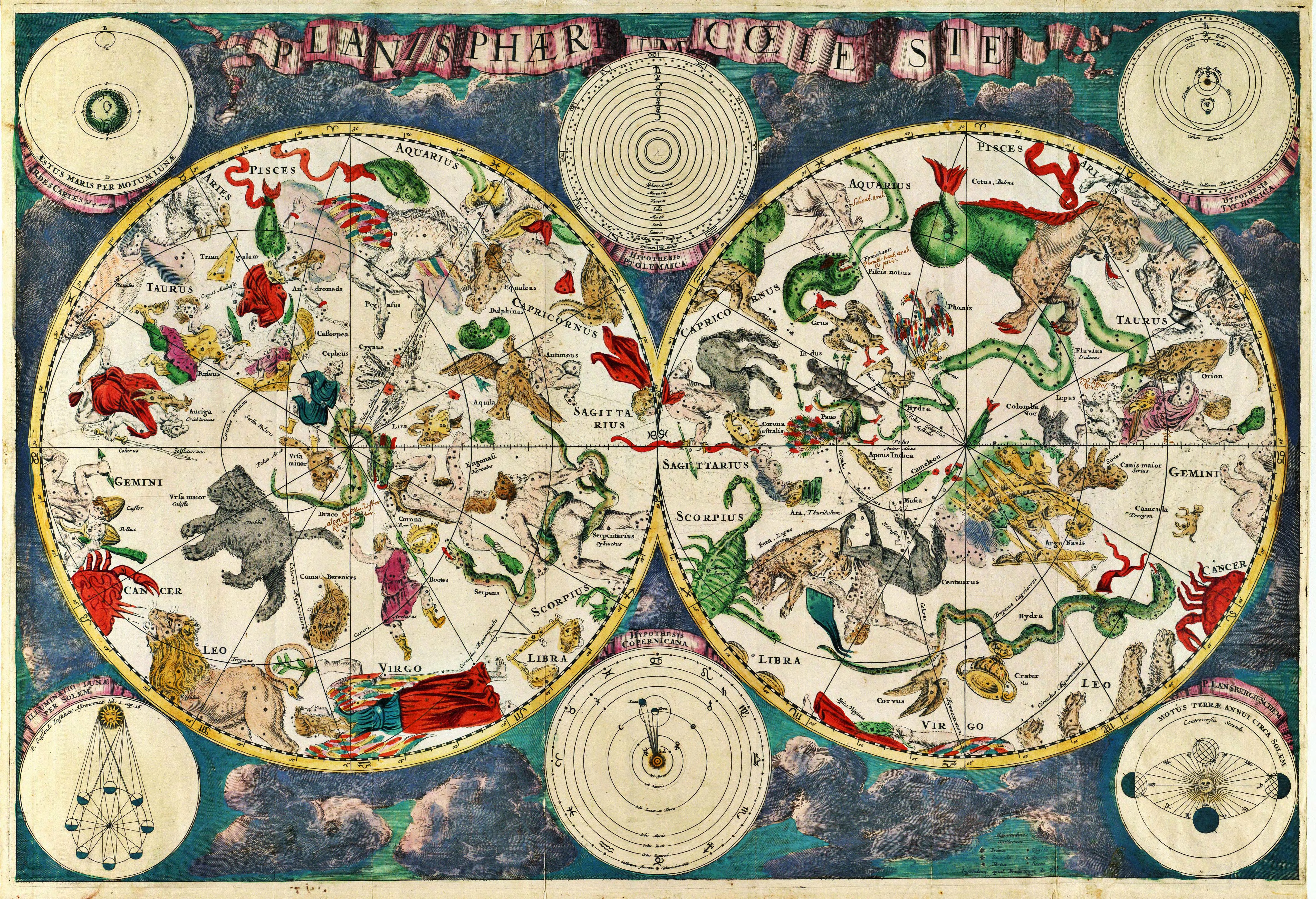
Latina:
Planisphæri cœleste
English:
Celestial map from the 17th century, by the Dutch cartographer Frederik de Wit.
Français :
Carte céleste du XVII ème siècle, réalisée par le cartographe hollandais Frederik de Wit. |
|||||||||
|---|---|---|---|---|---|---|---|---|---|---|
| Source |
Originally from en.wikipedia; description page is/was here. Scanned by Janke |
|||||||||
| Date |
10 March 2007 |
|||||||||
| Author |
|
|||||||||
| Permission (Reusing this image) |
This image is in the public domain due to its age. |
|||||||||
[edit] Original upload log
(All user names refer to en.wikipedia)
- 2007-03-10 18:20 Janke 1804×1236×8 (3237455 bytes) Celestial map from the 17th century, by the Dutch cartographer Frederik de Wit. Scanned by uploader
[edit] Licensing
| This image (or other media file) is in the public domain because its copyright has expired. This applies to the United States, Canada, the European Union and those countries with a copyright term of life of the author plus 70 years.
العربية | Asturianu | Български | Català | Česky | Dansk | Deutsch | English | Ελληνικά | Esperanto | Español | Euskara | فارسی | Français | Gaeilge | Galego | עברית | हिन्दी | Bahasa Indonesia | Italiano | 日本語 | 한국어 | Kurdî / كوردی | Lietuvių | Magyar | Nederlands | Norsk (nynorsk) | Македонски | Bahasa Melayu | Polski | Português | Română | Русский | Slovenčina | Slovenščina | Shqip | Suomi | Sámegiella | Türkçe | 中文(简体) | 中文(繁體) | 粵語 | +/- |
Historique du fichier
Cliquer sur une date et une heure pour voir le fichier tel qu’il était à ce moment-là
| Date et heure | Dimensions | Utilisateur | Commentaire | |
|---|---|---|---|---|
| actuel | 29 mai 2007 à 02:18 | 1 804×1 236 (3,09 Mio) | STyx | ({{Information |Description= {{la}}Planisphæri cœleste {{en}}Celestial map from the 17th century, by the Dutch cartographer Frederik de Wit. {{fr}}Carte céleste du XVII ème siècle, réalisée par le cartographe hollandais Frederik de Wit. {{du}}[http) |
Pages contenant l’image
Les pages ci-dessous contiennent cette image :
Métadonnées
Ce fichier contient des informations supplémentaires probablement ajoutées par l’appareil photo numérique ou le numériseur qui l’a acquis. Si le fichier a été modifié depuis son état original, certains détails peuvent ne pas refléter entièrement l’image modifiée.
| Orientation | Normale |
|---|---|
| Résolution horizontale | 300 dpi |
| Résolution verticale | 300 dpi |
| Logiciel utilisé | Adobe Photoshop CS Macintosh |
| Date de modification | 10 mars 2007 à 20:13 |
| Espace colorimétrique | 65535 |

