Image:Places of the 1859 Austro-Sardinian war.png
Un article de Wikipédia, l'encyclopédie libre.
Pas de plus haute résolution disponible.
Places_of_the_1859_Austro-Sardinian_war.png (649 × 306 pixels, taille du fichier : 39 Kio, type MIME : image/png)
| | Ce fichier provient de Wikimedia Commons?. Les informations le concernant sont affichées ci-dessous (procédure). |
[edit] Summary
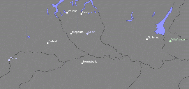
Español: Mapa de la segunda guerra italiana de la independencia
Map of the major locations of the Austro-Sardinian war of 1859.
Drawn by Panairjdde, May 2005

| This file is licensed under Creative Commons ShareAlike 1.0 License |
Historique du fichier
Cliquer sur une date et une heure pour voir le fichier tel qu’il était à ce moment-là
| Date et heure | Dimensions | Utilisateur | Commentaire | |
|---|---|---|---|---|
| actuel | 19 mai 2005 à 16:10 | 649×306 (39 Kio) | Panairjdde |
Pages contenant l’image
La page ci-dessous contient cette image :

