Image:Picton Lennox and Nueva.png
Un article de Wikipédia, l'encyclopédie libre.
Pas de plus haute résolution disponible.
Picton_Lennox_and_Nueva.png (800 × 600 pixels, taille du fichier : 21 Kio, type MIME : image/png)
| | Ce fichier provient de Wikimedia Commons?. Les informations le concernant sont affichées ci-dessous (procédure). |
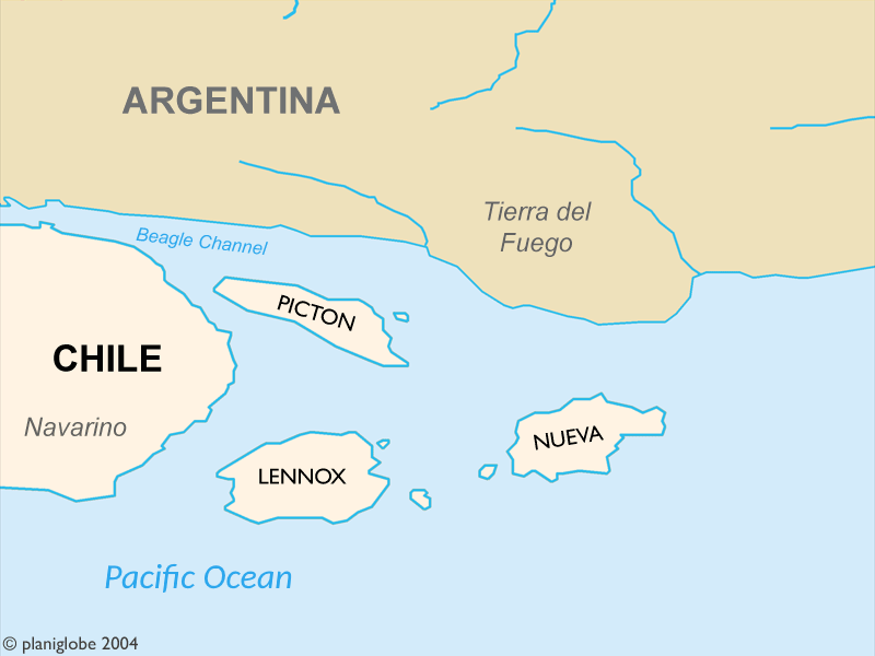
Largely self-made, using www.planiglobe.com (License) as source for cartographic data and colors from CIA World Factbook maps.
These Islands are part of Chile and where disputed by Chile and Argentina until 1985.
Author: Cantus
| This file is licensed under Creative Commons Attribution 2.5 License In short: you are free to distribute and modify the file as long as you attribute its author(s) or licensor(s). |
Historique du fichier
Cliquer sur une date et une heure pour voir le fichier tel qu’il était à ce moment-là
| Date et heure | Dimensions | Utilisateur | Commentaire | |
|---|---|---|---|---|
| actuel | 2 septembre 2005 à 00:24 | 800×600 (21 Kio) | B1mbo | (Largely self-made, using www.planiglobe.com ([http://www.planiglobe.com/eula.html License]) as source for cartographic data and colors from CIA World Factbook maps. Author: Cantus {{CopyrightedFreeUse}} Category:Maps of Chile) |
Pages contenant l’image
La page ci-dessous contient cette image :

