Image:Ph locator sulu jolo island.png
Un article de Wikipédia, l'encyclopédie libre.
Pas de plus haute résolution disponible.
Ph_locator_sulu_jolo_island.png (300 × 250 pixels, taille du fichier : 7 Kio, type MIME : image/png)
| | Ce fichier provient de Wikimedia Commons?. Les informations le concernant sont affichées ci-dessous (procédure). |
[edit] Summary
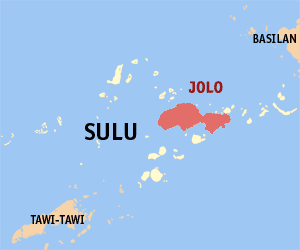
| Description |
Locator map of Jolo Island in the Philippine provincie Sulu |
|---|---|
| Source |
editted by Magalhães. Original map GFDL: Image:Ph locator sulu jolo.png from en:User:TheCoffee |
| Date |
30th of July 2006 |
| Author | |
| Permission (Reusing this image) |
GFDL |
[edit] Licensing

Historique du fichier
Cliquer sur une date et une heure pour voir le fichier tel qu’il était à ce moment-là
| Date et heure | Dimensions | Utilisateur | Commentaire | |
|---|---|---|---|---|
| actuel | 29 juillet 2006 à 17:02 | 300×250 (7 Kio) | Magalhães | ({{Information |Description=Locator map of Jolo Island in the Philippine provincie Sulu |Source=editted by ~~~. Original map GFDL: Image:Ph locator sulu jolo.png from en:User:TheCoffee |Date=30th of Juli 2006 |Author=~~~ |Permission=GFDL }} [[Cat) |
Pages contenant l’image
La page ci-dessous contient cette image :

