Image:Ph locator region 1.png
Un article de Wikipédia, l'encyclopédie libre.
Pas de plus haute résolution disponible.
Ph_locator_region_1.png (300 × 440 pixels, taille du fichier : 17 Kio, type MIME : image/png)
| | Ce fichier provient de Wikimedia Commons?. Les informations le concernant sont affichées ci-dessous (procédure). |
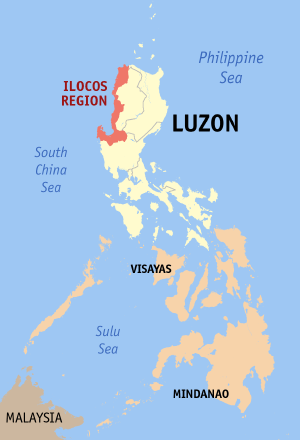
Map of The Philippines showing the location of Ilocos Region (Region I).
Source: English wikipedia

Historique du fichier
Cliquer sur une date et une heure pour voir le fichier tel qu’il était à ce moment-là
| Date et heure | Dimensions | Utilisateur | Commentaire | |
|---|---|---|---|---|
| actuel | 2 mai 2006 à 14:01 | 300×440 (17 Kio) | Magalhães | (updated version (2nd try)) |
| 1 mai 2006 à 10:45 | 300×440 (17 Kio) | Magalhães | (updated version) | |
| 9 août 2005 à 15:28 | 300×450 (11 Kio) | Magalhães | (Map of The Philippines showing the location of Ilocos Region (Region I). Source: [http://en.wikipedia.org/wiki/Image:Ph_locator_region_1.png English wikipedia] {{GFDL}} Category: Maps of the Philippines) |
Pages contenant l’image
La page ci-dessous contient cette image :

