Image:Ph locator map bataan.png
Un article de Wikipédia, l'encyclopédie libre.
Pas de plus haute résolution disponible.
Ph_locator_map_bataan.png (300 × 440 pixels, taille du fichier : 19 Kio, type MIME : image/png)
| | Ce fichier provient de Wikimedia Commons?. Les informations le concernant sont affichées ci-dessous (procédure). |
Source: en:Image:Ph locator map bataan.png
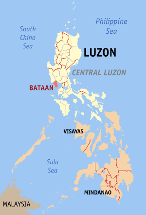
Map of the en:Philippines showing the location of en:Bataan.
Created and copyright (2003) by seav. Released under the GNU FDL.
 |
Permission is granted to copy, distribute and/or modify this document under the terms of the GNU Free Documentation License, Version 1.2 or any later version published by the Free Software Foundation; with no Invariant Sections, no Front-Cover Texts, and no Back-Cover Texts. Subject to disclaimers. Asturianu | Български | Català | Deutsch | English | Español | Français | Gaeilge | Italiano | 한국어 | 日本語 | Polski | Português | Română | Türkçe | +/- |
- 14:11, June 15, 2003 . . Seav (14085 bytes) (Map of the Philippines showing the location of Bataan.)
Historique du fichier
Cliquer sur une date et une heure pour voir le fichier tel qu’il était à ce moment-là
| Date et heure | Dimensions | Utilisateur | Commentaire | |
|---|---|---|---|---|
| actuel | 24 janvier 2006 à 09:12 | 300×440 (19 Kio) | Magalhães | (updated version) |
| 29 juillet 2005 à 15:30 | 300×450 (14 Kio) | Bluemask | (from en:Image:Ph locator map bataan.png Map of the en:Philippines showing the location of en:Bataan. Created and copyright (2003) by seav. Released under the GNU FDL. {{GFDL}} * [h) |
Pages contenant l’image
Les pages ci-dessous contiennent cette image :

