Image:Pearl River Delta Area.png
Un article de Wikipédia, l'encyclopédie libre.

Taille de cet aperçu : 750 × 600 pixels
Image en plus haute résolution (1 000 × 800 pixels, taille du fichier : 182 Kio, type MIME : image/png)
| | Ce fichier provient de Wikimedia Commons?. Les informations le concernant sont affichées ci-dessous (procédure). |
[edit] Summary
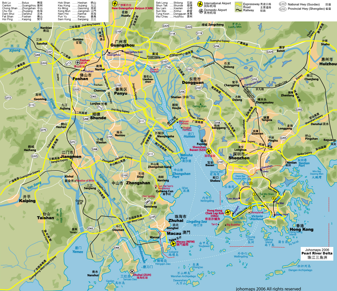
| Description |
Pearl River Delta area, showing boundaries of the Special Administrative Regions of Honk Kong and Macau (in green), and the bordering Guangdong Prefectures Map drawn in october 2007 using various sources, mainly : |
|---|---|
| Source |
own work |
| Date |
October 11 2007 |
| Author | |
| Permission (Reusing this image) |
see below |
[edit] Licensing
|
Historique du fichier
Cliquer sur une date et une heure pour voir le fichier tel qu’il était à ce moment-là
| Date et heure | Dimensions | Utilisateur | Commentaire | |
|---|---|---|---|---|
| actuel | 11 octobre 2007 à 21:38 | 1 000×800 (182 Kio) | Croquant | (lighter color for Province name) |
| 11 octobre 2007 à 21:05 | 1 000×800 (186 Kio) | Croquant | (Pearl River Chinese name updated) | |
| 11 octobre 2007 à 20:57 | 1 000×800 (185 Kio) | Croquant | (Province and River names) | |
| 11 octobre 2007 à 18:54 | 1 000×800 (167 Kio) | Croquant | (edition Jiangmen Prefecture) | |
| 11 octobre 2007 à 17:44 | 1 000×800 (152 Kio) | Croquant | (== Summary == {{Information |Description=Pearl River Delta area, showing boundaries of the Special Administrative Regions of Honk Kong and Macau, and the bordering Guangdong Prefectures Map drawn in october 2007 using various sources, mainly : * [http://) |

