Image:Pamlicorivermap.png
Un article de Wikipédia, l'encyclopédie libre.
Pas de plus haute résolution disponible.
Pamlicorivermap.png (500 × 415 pixels, taille du fichier : 144 Kio, type MIME : image/png)
| | Ce fichier provient de Wikimedia Commons?. Les informations le concernant sont affichées ci-dessous (procédure). |
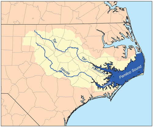
This is a map of the Pamlico Sound watershed, including the Pamlico, Tar, and Neuse rivers. I, Karl Musser, created it based on USGS data.
|
Historique du fichier
Cliquer sur une date et une heure pour voir le fichier tel qu’il était à ce moment-là
| Date et heure | Dimensions | Utilisateur | Commentaire | |
|---|---|---|---|---|
| actuel | 12 février 2007 à 21:49 | 500×415 (144 Kio) | Kmusser | (This is a map of the Pamlico Sound watershed, including the Pamlico, Tar, and Neuse rivers. I, Karl Musser, created it based on USGS data. {{self|cc-by-sa-2.5}} [[Category:Maps of rivers of the Unit) |
Pages contenant l’image
La page ci-dessous contient cette image :

