Image:Palliser's Triangle map.png
Un article de Wikipédia, l'encyclopédie libre.
Taille de cet aperçu : 780 × 600 pixels
Image en plus haute résolution (1 000 × 769 pixels, taille du fichier : 301 Kio, type MIME : image/png)
| | Ce fichier provient de Wikimedia Commons?. Les informations le concernant sont affichées ci-dessous (procédure). |
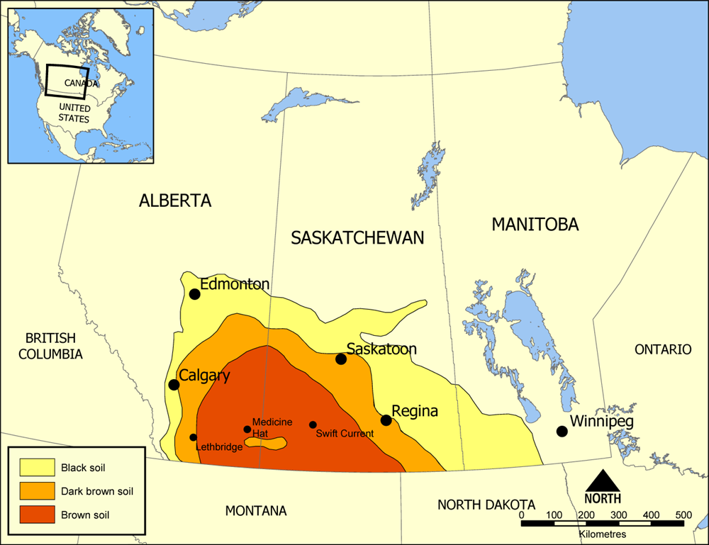
Map showing the extent of Palliser's Triangle in Western Canada. The area covers parts of Alberta, Saskatchewan, and Manitoba and is notable for its lack of trees. The lack of sturdy vegetation devastated the area during the Dust Bowl of the 1930s, but modern irrigation has allowed it to become an important wheat and beef area.
Created by NormanEinstein July 18, 2005.

Historique du fichier
Cliquer sur une date et une heure pour voir le fichier tel qu’il était à ce moment-là
| Date et heure | Dimensions | Utilisateur | Commentaire | |
|---|---|---|---|---|
| actuel | 18 juillet 2005 à 17:50 | 1 000×769 (301 Kio) | NormanEinstein | (Map showing the extent of Palliser's Triangle in Western Canada. The area covers parts of Alberta, Saskatchewan, and Manitoba and is notable for its lack of trees. The lack of sturdy vegetation devastated the area during the Dust Bowl of the 1930s, but mo) |
Pages contenant l’image
Les pages ci-dessous contiennent cette image :

