Image:Operation Downfall - Map.jpg
Un article de Wikipédia, l'encyclopédie libre.
Taille de cet aperçu : 779 × 600 pixels
Image en plus haute résolution (1 260 × 970 pixels, taille du fichier : 165 Kio, type MIME : image/jpeg)
| | Ce fichier provient de Wikimedia Commons?. Les informations le concernant sont affichées ci-dessous (procédure). |
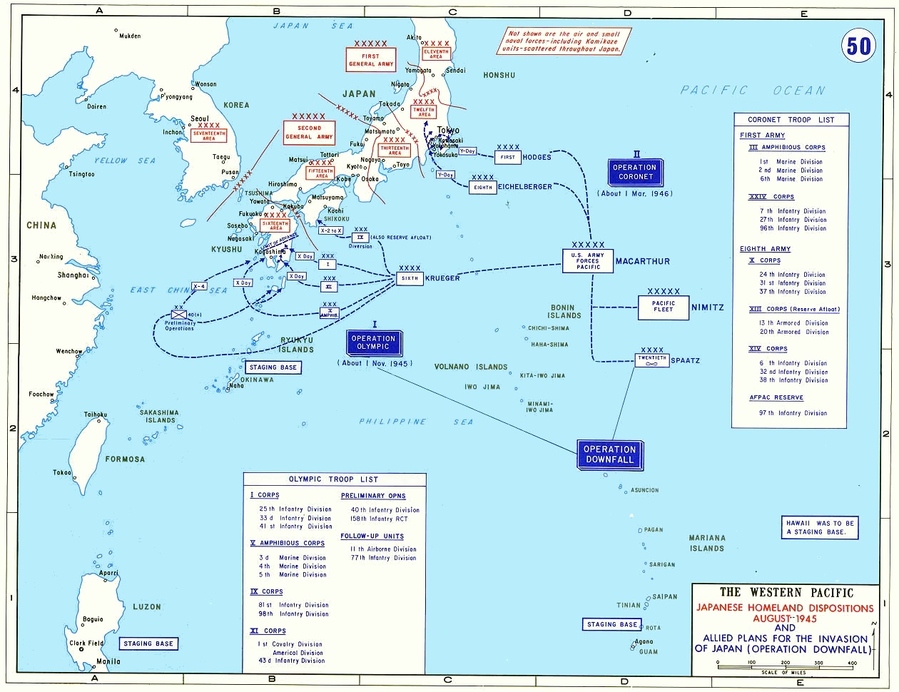
- Description: Operation Downfall - 1945
- Source: www.dean.usma.edu
- Background information:
In 1938 the predecessors of what is today The Department of History at the United States Military Academy began developing a series of campaign atlases to aid in teaching cadets a course entitled, "History of the Military Art." Since then, the Department has produced over six atlases and more than one thousand maps, encompassing not only America’s wars but global conflicts as well.
In keeping abreast with today's technology, the Department of History is providing these maps on the internet as part of the department's outreach program. The maps were created by the United States Military Academy’s Department of History and are the digital versions from the atlases printed by the United States Defense Printing Agency. We gratefully acknowledge the accomplishments of the department's former cartographer, Mr. Edward J. Krasnoborski, along with the works of our present cartographer, Mr. Frank Martini.
Please be aware that these maps are large in file size and may require substantial download times.
| This image is a work of a U.S. Army soldier or employee, taken or made during the course of the person's official duties. As a work of the U.S. federal government, the image is in the public domain. |
 |
[edit] Format
This image was (or all images in this article or category were) uploaded in the JPEG format.
However, it contains information that could be stored more efficiently or more accurately in the PNG format or SVG format. If possible, please upload a PNG or SVG version of this image without compression artifacts, derived from a non-JPEG source or with existing artifacts removed. After doing so, please:
- Find all pages in all Wikimedia projects that use this image, and replace the old image with the new image in each.
- Mark this image as having been superseded by adding one of these templates.
Deutsch | English | Español | Français | 日本語 | Português | Русский | +/-
 |
This Map image should be recreated using vector graphics as an SVG file. This has several advantages; see Commons:Media for cleanup for more information. If an SVG form of this image is already available, please upload it. After uploading an SVG, replace this template with template {{Vector version available|new image name.svg}} in this image. |
|
العربية | Български | Català | Česky | Dansk | Deutsch | English | Esperanto | Español | Français | 한국어 | Italiano | Magyar | Lietuvių | Nederlands | 日本語 | Polski | Português | Română | Русский | Suomi | Svenska | Türkçe | Українська | Tiếng Việt | मराठी | 中文(繁體) | 中文(简体) | +/- |
|
Historique du fichier
Cliquer sur une date et une heure pour voir le fichier tel qu’il était à ce moment-là
| Date et heure | Dimensions | Utilisateur | Commentaire | |
|---|---|---|---|---|
| actuel | 17 juin 2005 à 19:53 | 1 260×970 (165 Kio) | W.wolny |
Pages contenant l’image
La page ci-dessous contient cette image :

