Image:Old map 1807 plan.jpg
Un article de Wikipédia, l'encyclopédie libre.
Taille de cet aperçu : 419 × 599 pixels
Image en plus haute résolution (655 × 937 pixels, taille du fichier : 146 Kio, type MIME : image/jpeg)
| | Ce fichier provient de Wikimedia Commons?. Les informations le concernant sont affichées ci-dessous (procédure). |
[edit] Summary
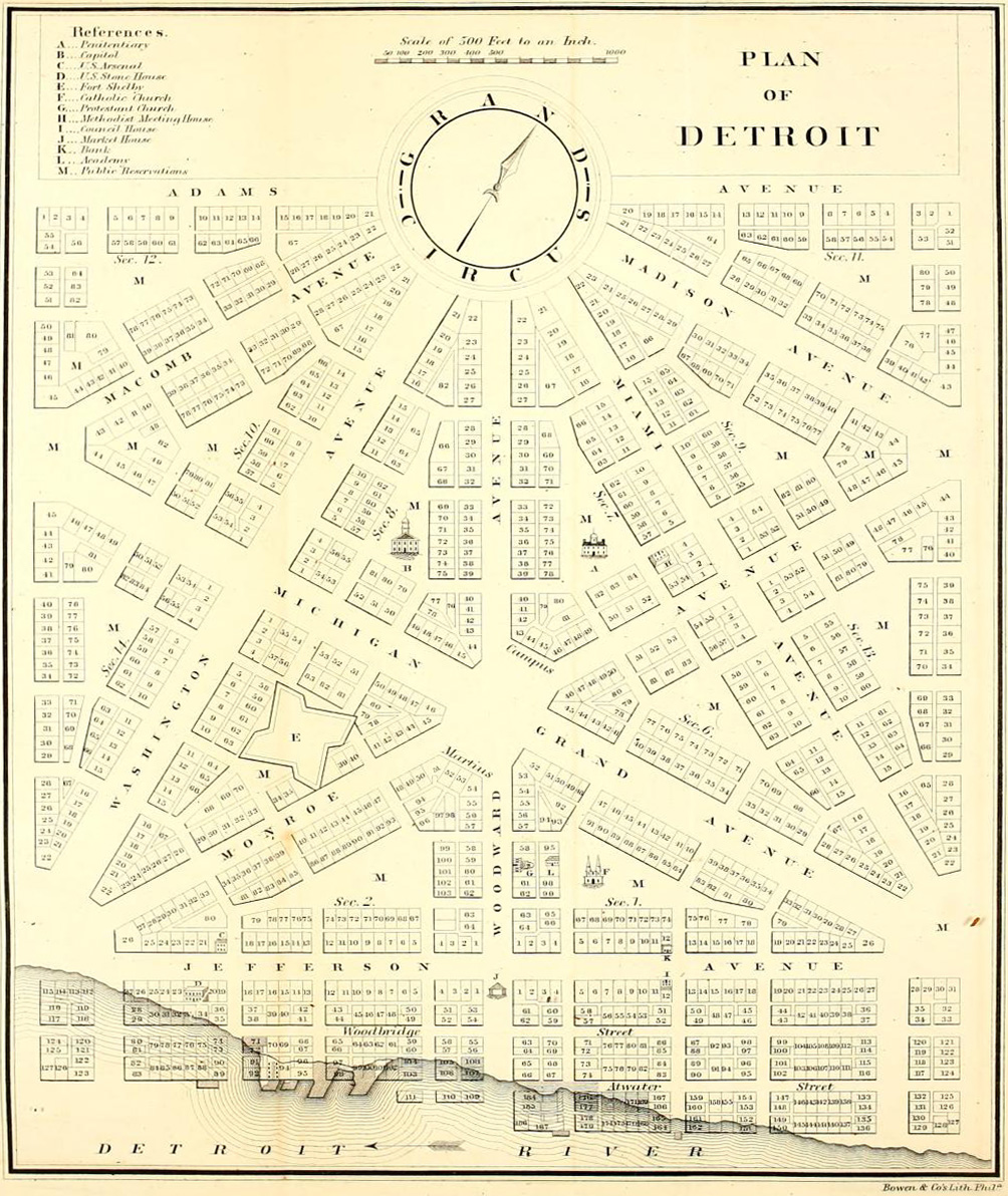
Detroit city layout circa 1807 following the 1805 fire that destroyed most of the city. From the Detroit Historical Museum site
[edit] Licensing
|
|
This media file is in the public domain in the United States. This applies to U.S. works where the copyright has expired, often because its first publication occurred prior to January 1, 1923. See this page for further explanation.
|
|
|
Deutsch | English | Español | Français | Gaeilge | Galego | Italiano | Nederlands | 中文(简体) | +/- |
||
|
|
This image might not be in the public domain outside of the United States (this especially applies in Canada, China (not Hong Kong, Macao, or Taiwan Area), Germany, Mexico, and Switzerland). The creator and year of publication are essential information and must be provided. See Wikipedia:Public domain and Wikipedia:Copyrights for more details. |
Historique du fichier
Cliquer sur une date et une heure pour voir le fichier tel qu’il était à ce moment-là
| Date et heure | Dimensions | Utilisateur | Commentaire | |
|---|---|---|---|---|
| actuel | 8 juillet 2007 à 16:54 | 655×937 (146 Kio) | DeltaWeb | (== Summary == Detroit city layout circa 1807 following the 1805 fire that destroyed most of the city. From the Detroit Historical Museum site == Licensing == {{PD-US}} Category:Michigan maps Category:Images of Detroit, Michigan [[Category:Images ) |
Pages contenant l’image
La page ci-dessous contient cette image :

