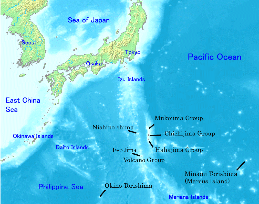
Image:Ogasawara islands.png
Un article de Wikipédia, l'encyclopédie libre.
Taille de cet aperçu : 760 × 600 pixels
Image en plus haute résolution (1 011 × 798 pixels, taille du fichier : 296 Kio, type MIME : image/png)
| | Ce fichier provient de Wikimedia Commons?. Les informations le concernant sont affichées ci-dessous (procédure). |
Map of Ogasawara Islands. Created by Map of ogasawara islands.png
| This image is in the public domain because came from the site http://www.demis.nl/home/pages/Gallery/examples.htm and was released by the copyright holder. Permission is granted to copy, distribute and/or modify this map since it is based on free of copyright images from: www.demis.nl. See also approval email on de.wp and its clarification. |
Historique du fichier
Cliquer sur une date et une heure pour voir le fichier tel qu’il était à ce moment-là
| Date et heure | Dimensions | Utilisateur | Commentaire | |
|---|---|---|---|---|
| actuel | 1 janvier 2008 à 00:01 | 1 011×798 (296 Kio) | Sagredo | ( Created by [http://commons.wikimedia.org/wiki/Image:Map_of_ogasawara_islands.png Map of ogasawara islands.png] {{Information |Description=Map of Ogasawara Islands. |Source= |Date= |Author= |Permission={{demis-pd}} }}) |
| 30 avril 2006 à 07:29 | 1 011×798 (260 Kio) | Tdk | (Map of Ogasawara Islands. Created by [Image:Map of ogasawara islands.png] {{demis-pd}}) |
Pages contenant l’image
La page ci-dessous contient cette image :

