Image:Nyiragongo and Nyamuragira - PIA03337.png
Un article de Wikipédia, l'encyclopédie libre.
Pas de plus haute résolution disponible.
Nyiragongo_and_Nyamuragira_-_PIA03337.png (670 × 311 pixels, taille du fichier : 224 Kio, type MIME : image/png)
| | Ce fichier provient de Wikimedia Commons?. Les informations le concernant sont affichées ci-dessous (procédure). |
[edit] Summary
| Description |
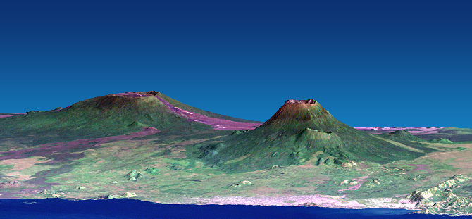
Depiction of the Nyiragongo and Nyamuragira volcanoes, based on data from the Shuttle Radar Topography Mission and Landsat. Vertical scale exaggerated (1.5x). |
|---|---|
| Source |
[1] (converted to PNG). Further information: [2]. Photo ID: PIA03337 |
| Date |
February 2000 - December 2001 |
| Author |
NASA/JPL/NIMA |
| Permission (Reusing this image) |
see below |
| Other versions | Image:Nyiragongo and Nyamuragira - PIA03337.jpg |
| This image or video was catalogued by Jet Propulsion Lab of the United States National Aeronautics and Space Administration (NASA) under Photo ID: PIA03337. This tag does not indicate the copyright status of the attached work. A normal copyright tag is still required. See Commons:Licensing for more information. |
[edit] Licensing
|
|
This file is in the public domain because it was created by NASA. NASA copyright policy states that "NASA material is not protected by copyright unless noted". (NASA copyright policy page or JPL Image Use Policy).
Deutsch | English | Español | Français | Nederlands | Português | Русский | 中文(简体) | 中文(繁體) | +/- |
|
 |
Warnings:
|
Historique du fichier
Cliquer sur une date et une heure pour voir le fichier tel qu’il était à ce moment-là
| Date et heure | Dimensions | Utilisateur | Commentaire | |
|---|---|---|---|---|
| actuel | 20 décembre 2007 à 11:48 | 670×311 (224 Kio) | Avenue | ({{Information |Description=Depiction of the Nyiragongo and Nyamuragira volcanoes, based on data from the Shuttle Radar Topography Mission and Landsat. |Source=[http://photojournal.jpl.nasa.gov/jpeg/PIA03337.tif] (converted to PNG). Further information: [h) |
Pages contenant l’image
La page ci-dessous contient cette image :

