Image:Nisyros.jpg
Un article de Wikipédia, l'encyclopédie libre.
Taille de cet aperçu : 647 × 600 pixels
Image en plus haute résolution (1 236 × 1 146 pixels, taille du fichier : 169 Kio, type MIME : image/jpeg)
| | Ce fichier provient de Wikimedia Commons?. Les informations le concernant sont affichées ci-dessous (procédure). |
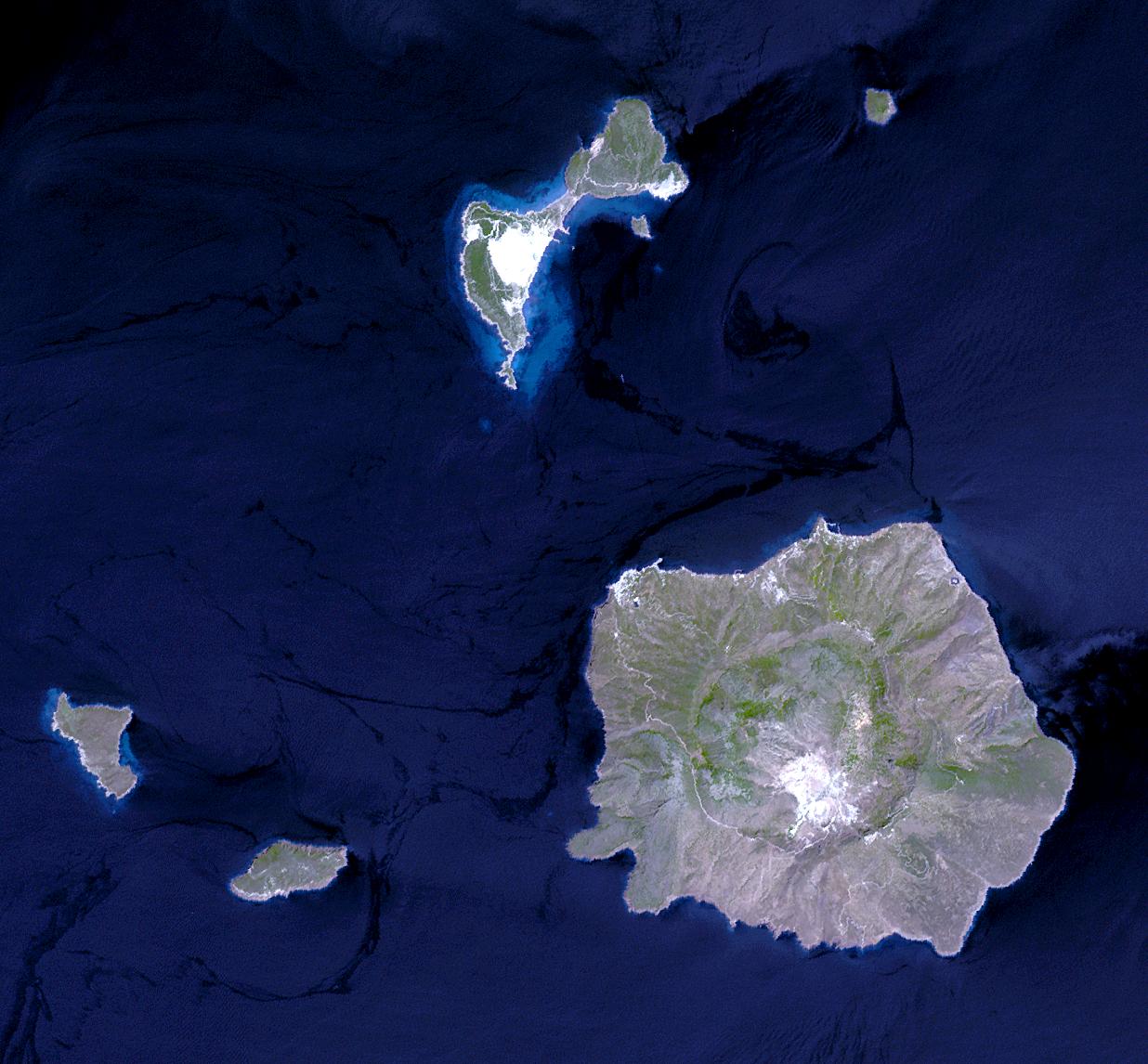
Nisyros Island, Aegean Sea (JPG) (173,039 bytes) ( 1,236 x 1,146 ) Nisyros is an active volcano in the Eastern edge of the South Aegean volcanic arc. It covers an area of 41.2 square kilometers and reaches a height of 698 meters. It is surrounded by 4 other small uninhabited volcanic islets. Nisyros is the youngest volcanic cone in the Aegean. Major volcanic activity is roughly estimated to have ended about 30,000 - 15,000 years ago. Since then superheated geothermal fluids triggered hydrothermal explosions, blasting the covering formations. Ten impressive craters of hydrothermal explosions with a diameter up to 300 m decorate the southeast part of the caldera floor. The most recent was created in 1887. This simulated natural color ASTER image is centered near 36.6 degrees north longitude, 27.2 degrees east latitude, covers an area of 18.5 x 17.2 km, and was acquired on July 29, 2004.
Please give credit for these images to: NASA/GSFC/METI/ERSDAC/JAROS, and U.S./Japan ASTER Science Team
|
|
This file is in the public domain because it was created by NASA. NASA copyright policy states that "NASA material is not protected by copyright unless noted". (NASA copyright policy page or JPL Image Use Policy).
Deutsch | English | Español | Français | Nederlands | Português | Русский | 中文(简体) | 中文(繁體) | +/- |
|
 |
Warnings:
|
Historique du fichier
Cliquer sur une date et une heure pour voir le fichier tel qu’il était à ce moment-là
| Date et heure | Dimensions | Utilisateur | Commentaire | |
|---|---|---|---|---|
| actuel | 1 juin 2005 à 00:33 | 1 236×1 146 (169 Kio) | Fxer | ([http://asterweb.jpl.nasa.gov/gallery-detail.asp?name=nisyros Nisyros Island, Aegean Sea] (JPG) (173,039 bytes) ( 1,236 x 1,146 ) Nisyros is an active volcano in the Eastern edge of the South Aegean volcanic arc. It covers an area of 41.2 square kilometer) |
Pages contenant l’image
La page ci-dessous contient cette image :

