Image:Niger carte.gif
Un article de Wikipédia, l'encyclopédie libre.
Pas de plus haute résolution disponible.
Niger_carte.gif (330 × 355 pixels, taille du fichier : 12 Kio, type MIME : image/gif)
| | Ce fichier provient de Wikimedia Commons?. Les informations le concernant sont affichées ci-dessous (procédure). |
[edit] Summary
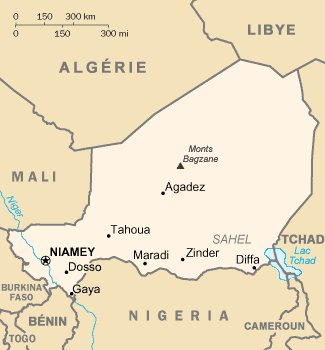
| Description |
French map of Niger |
|---|---|
| Source |
CIA World Factbook |
| Date |
of this version : February 2006 |
| Author |
of the translation : Eric Gaba (Sting) |
| Permission (Reusing this image) |
PD |
| Other versions | original English version : Image:Ng-map.png |
Français :
- Sujet : Carte en français du Niger ;
- Source : CIA World Factbook / Wikipédia francophone ;
- Autre version disponible : anglophone : Image:Ng-map.png
- Auteur de la traduction : Eric Gaba (fr:Sting) ;
- Date : Février 2006.
File History of the French Wikipedia :
(suppr) (actu) 3 février 2006 à 17:16 . . Sting (Discuter) . . 330x355 (12 629 octets) (Compléments; correction lac Tchad)
(suppr) (rétab) 3 février 2006 à 16:43 . . Sting (Discuter) . . 330x355 (10 527 octets) (Traductions)
(suppr) (rétab) 17 septembre 2003 à 20:12 . . Looxix (Discuter) . . 330x355 (9 576 octets)
English: This map was made or improved by the Wikigraphists of the Atelier graphique. You can propose maps or images to clean up and improve as well.
Esperanto: Ĉi tiu mapo estis kreita aŭ plibonigita de la Vikigrafistoj el la Grafika laborgrupo. Vi ankaŭ povas tie proponi mapojn aŭ bildojn plibonigendajn.
Español: Este mapa ha sido confeccionado o mejorado por los Wikígrafos del Taller gráfico. Puedes proponer la mejora de cualquier imagen a través de la página de Peticiones.
Français : Cette carte a été créée ou améliorée par les Wikigraphistes de l'Atelier graphique. Vous pouvez également y proposer des cartes ou des images à améliorer.
Türkçe: Bu harita Atelier graphique'ten Wikigraphistes'ler tarafından yapıldı veya geliştirildi. Siz de haritalar veya resimleri temizlemek veya geliştirmek için teklif edebilirsiniz.
[edit] Licensing
| This image is in the public domain because it contains materials that originally came from the United States Central Intelligence Agency's World Factbook.
Deutsch | English | Español | Français | 日本語 | Nederlands | 한국어 | Português | தமிழ் | Magyar | +/- |
 |
| This work was previously under Public Domain, or a Free License. It has been digitally enhanced and/or modified. This derivative work has been (or is hereby) released into the public domain by its author, Sting at the French Wikipedia project. This applies worldwide. In some countries this is not legally possible; if so: |
Historique du fichier
Cliquer sur une date et une heure pour voir le fichier tel qu’il était à ce moment-là
| Date et heure | Dimensions | Utilisateur | Commentaire | |
|---|---|---|---|---|
| actuel | 17 juin 2006 à 01:46 | 330×355 (12 Kio) | Sting | ({{Information |Description=French map of Niger |Source=[http://www.cia.gov/cia/publications/factbook/ CIA World Factbook]<br/>/ French Wikipedia |Date=of this version : February 2006 |Author=of the translation : Eric Gaba (Sting) |Permissio) |
Pages contenant l’image
Les pages ci-dessous contiennent cette image :

