Image:MSH82 lahar from march 82 eruption 03-21-82.jpg
Un article de Wikipédia, l'encyclopédie libre.
Taille de cet aperçu : 800 × 511 pixels
Image en plus haute résolution (2 976 × 1 901 pixels, taille du fichier : 1,13 Mio, type MIME : image/jpeg)
| | Ce fichier provient de Wikimedia Commons?. Les informations le concernant sont affichées ci-dessous (procédure). |
[edit] Summary
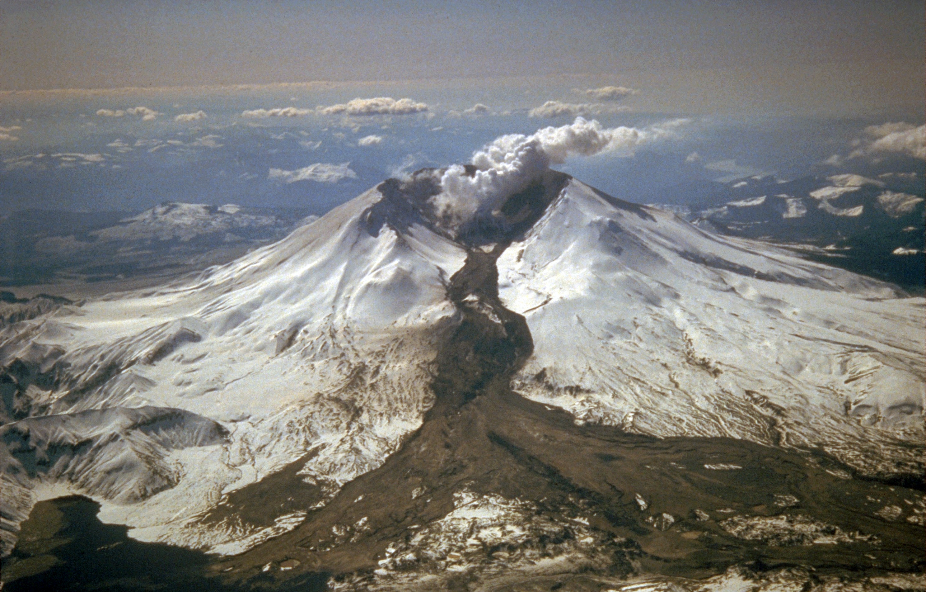
USGS photo of Mt. Saint Helens.
Caption: Mount St. Helens erupted often between 1980 and 1986. An explosive eruption on March 19, 1982, sent pumice and ash 9 miles (14 kilometers) into the air, and resulted in a lahar (the dark deposit on the snow) flowing from the crater into the North Fork Toutle River valley. Part of the lahar entered Spirit Lake (lower left corner) but most of the flow went west down the Toutle River, eventually reaching the Cowlitz River, 50 miles (80 kilometers) downstream.
USGS Photograph taken on March 21, 1982, by Tom Casadevall.
From:
- http://vulcan.wr.usgs.gov/Volcanoes/MSH/SlideSet/ljt_slideset.html
- http://vulcan.wr.usgs.gov/Imgs/Jpg/MSH/Images/MSH82_lahar_from_march_82_eruption_03-21-82.jpg
[edit] Licensing
| This image is in the public domain because it contains materials that originally came from the United States Geological Survey, an agency of the United States Department of Interior. For more information, see the official USGS copyright policy |
|
Historique du fichier
Cliquer sur une date et une heure pour voir le fichier tel qu’il était à ce moment-là
| Date et heure | Dimensions | Utilisateur | Commentaire | |
|---|---|---|---|---|
| actuel | 9 août 2005 à 08:14 | 2 976×1 901 (1,13 Mio) | Complex01 | (USGS photo of Mt. Saint Helens. '''Caption''': Mount St. Helens erupted often between 1980 and 1986. An explosive eruption on March 19, 1982, sent pumice and ash 9 miles (14 kilometers) into the air, and resulted in a lahar (the dark deposit on the snow)) |
Pages contenant l’image
Les pages ci-dessous contiennent cette image :

