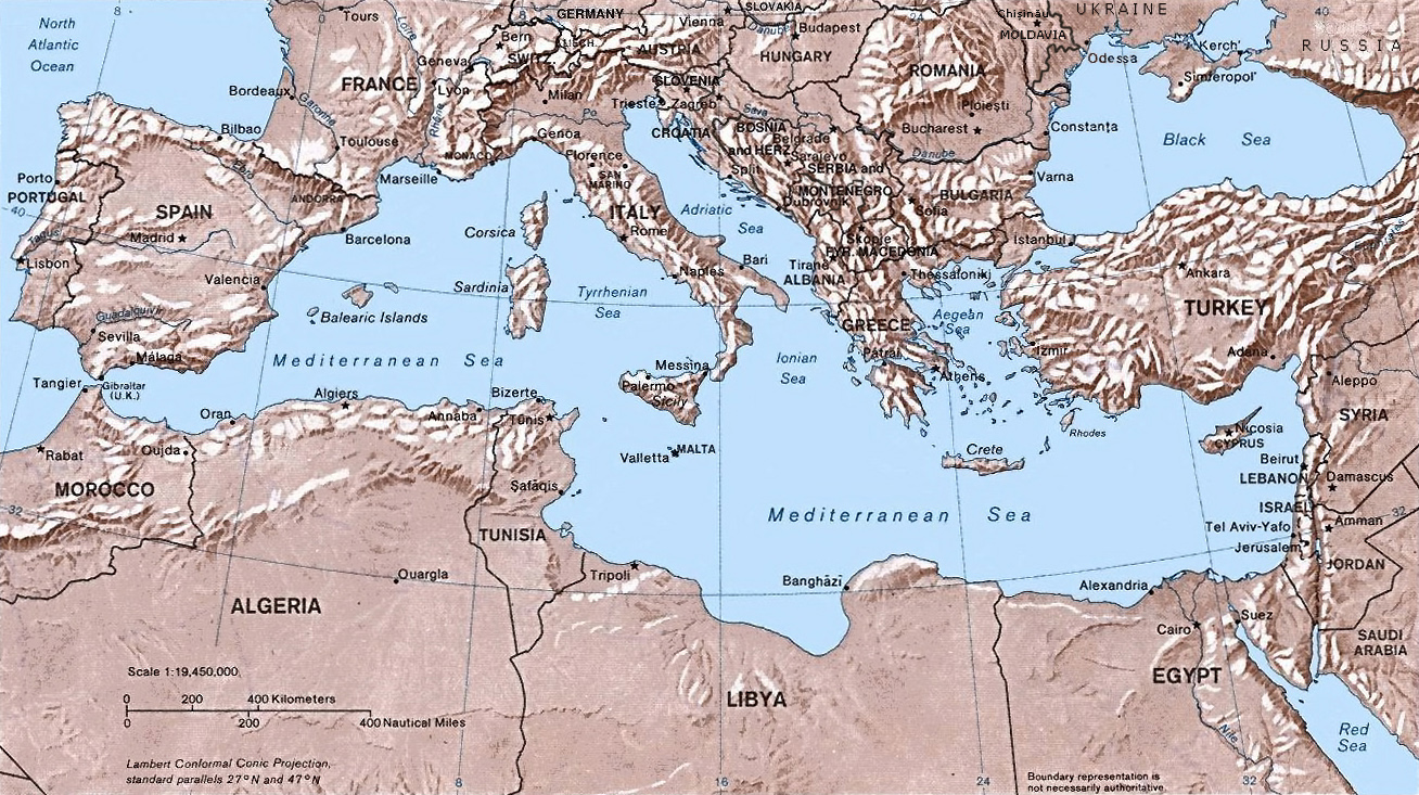
Image:Mediterranean Relief.jpg
Un article de Wikipédia, l'encyclopédie libre.
Taille de cet aperçu : 800 × 476 pixels
Image en plus haute résolution (1 332 × 792 pixels, taille du fichier : 274 Kio, type MIME : image/jpeg)
| | Ce fichier provient de Wikimedia Commons?. Les informations le concernant sont affichées ci-dessous (procédure). |
Shaded relief map of the Mediterranean Sea.
The original map was created in 1982 by the Central Intelligence Agency ([1], specifically [2]). This version was produced by w:User:Joy, who originally uploaded it to the English Wikipedia:
- 23:46, 28 Sep 2004 . . Joy (343433 bytes) (an update after 22 years :) added borders and names for the ex-yu republics (si,hr,ba,cs,mk); corrected names for de,sk; dropped su name but didn't bother drawing the md/uk/ru borders or names because they're not near the topic at hand, and it's tiresome)
| This work is in the public domain in the United States because it is a work of the United States Federal Government under the terms of Title 17, Chapter 1, Section 105 of the US Code. See Copyright.
Note: This only applies to works of the Federal Government and not to the work of any individual U.S. state, territory, commonwealth, county, municipality, or any other subdivision. العربية | Български | Česky | Deutsch | English | Español | Français | Magyar | Italiano | 日本語 | 한국어 | Polski | Português | 中文(繁體) | 中文(简体) | +/- |
 |
Historique du fichier
Cliquer sur une date et une heure pour voir le fichier tel qu’il était à ce moment-là
| Date et heure | Dimensions | Utilisateur | Commentaire | |
|---|---|---|---|---|
| actuel | 21 décembre 2005 à 21:22 | 1 332×792 (274 Kio) | Lhgodoy | (Noise removal in original image) |
| 4 décembre 2004 à 22:59 | 1 332×792 (335 Kio) | Alfio | (Map of the Mediterranean Sea) |
Pages contenant l’image
La page ci-dessous contient cette image :


![[2]](http://www.lib.utexas.edu/maps/europe/mediterranean_rel82.jpg)