Image:Matabeleland.png
Un article de Wikipédia, l'encyclopédie libre.
Pas de plus haute résolution disponible.
Matabeleland.png (582 × 599 pixels, taille du fichier : 285 Kio, type MIME : image/png)
| | Ce fichier provient de Wikimedia Commons?. Les informations le concernant sont affichées ci-dessous (procédure). |
| Description |
|
||
|---|---|---|---|
| Source |
Modified version of Image:Matabeleland.gif. |
||
| Date |
March 9, 2008 |
||
| Author |
Scanned by Ulamm (talk • contribs), modified by Fvasconcellos (talk • contribs) |
||
| Permission (Reusing this image) |
|

Historique du fichier
Cliquer sur une date et une heure pour voir le fichier tel qu’il était à ce moment-là
| Date et heure | Dimensions | Utilisateur | Commentaire | |
|---|---|---|---|---|
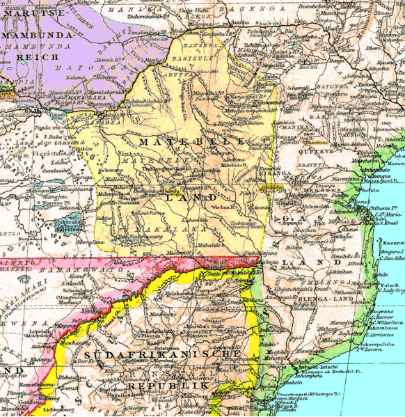
| actuel | 9 mars 2008 à 21:26 | 582×599 (285 Kio) | Fvasconcellos | ({{Information |Description = {{en|An 1887 map of southern Africa showing {{w|Matabeleland}} (part of present-day {{w|Zimbabwe}}).}} {{RetouchedPicture|Extraneous German-language labels removed, converted to PNG format|editor=Fvasconcellos|orig=Matabelelan) |
Pages contenant l’image
Les pages ci-dessous contiennent cette image :

