Image:Map of NATO countries.png
Un article de Wikipédia, l'encyclopédie libre.
Pas de plus haute résolution disponible.
Map_of_NATO_countries.png (742 × 283 pixels, taille du fichier : 12 Kio, type MIME : image/png)
| | Ce fichier provient de Wikimedia Commons?. Les informations le concernant sont affichées ci-dessous (procédure). |
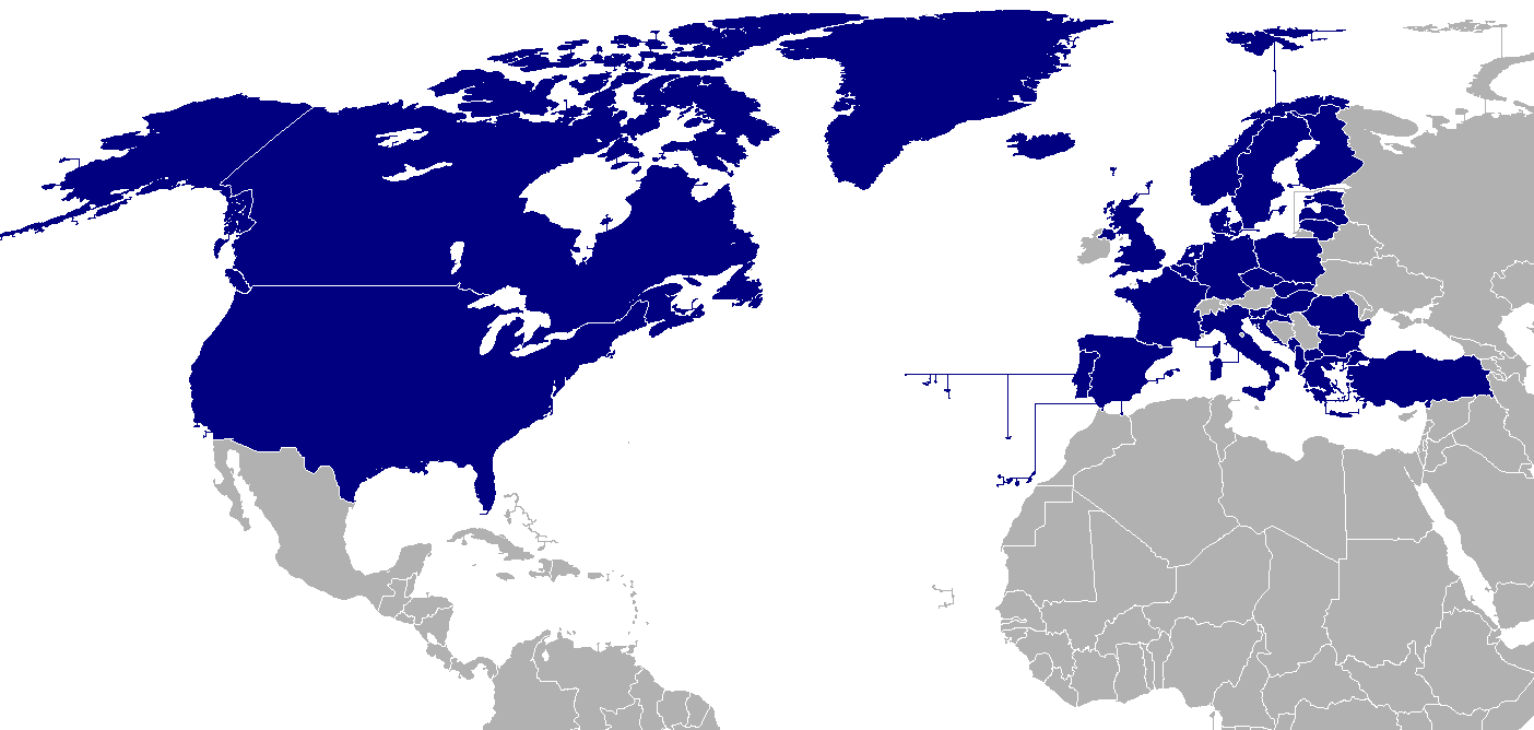
Description: Map of NATO countries.
██ NATO member states
██ Countries due to join 2009
Source: taken from the English Wikipedia.
The image was originally made by User:Donarreiskoffer. This version (corrected regarding Northern Ireland) is identical (except the size) to one uploaded by en:User:Mrowlinson which didn't have a copyright license.

 |
This map image should be recreated using vector graphics as an SVG file. This has several advantages; see Commons:Media for cleanup for more information. If an SVG form of this image is already available, please upload it. After uploading an SVG, replace this template with template {{Vector version available|new image name.svg}} in this image. |
|
العربية | Български | Català | Česky | Dansk | Deutsch | English | Esperanto | Español | Français | 한국어 | Italiano | Magyar | Lietuvių | Nederlands | 日本語 | Polski | Português | Română | Русский | Suomi | Svenska | Türkçe | Українська | Tiếng Việt | मराठी | 中文(繁體) | 中文(简体) | +/- |
|
Historique du fichier
Cliquer sur une date et une heure pour voir le fichier tel qu’il était à ce moment-là
| Date et heure | Dimensions | Utilisateur | Commentaire | |
|---|---|---|---|---|
| actuel | 13 mai 2008 à 01:12 | 742×283 (12 Kio) | Patrickneil | (Adding Kosovo and Croatia's Adriatic coast, as proposed by en:User:OettingerCroat at the [[http://en.wikipedia.org/wiki/Image_talk:Map_of_NATO_countries.png English talk page].) |
| 3 avril 2008 à 16:47 | 742×283 (10 Kio) | Gugganij | (ALB & CRO are not yet members) | |
| 3 avril 2008 à 15:22 | 742×283 (15 Kio) | Sparrowman980 | (The image was originally made by User:Donarreiskoffer. This version (corrected regarding Northern Ireland) is identical (except the size) to one uploaded by en:User:Mrowlinson which didn't have a copyright license. ) | |
| 3 avril 2008 à 15:21 | 742×283 (15 Kio) | Sparrowman980 | (The image was originally made by User:Donarreiskoffer. This version (corrected regarding Northern Ireland) is identical (except the size) to one uploaded by en:User:Mrowlinson which didn't have a copyright license.) | |
| 18 juillet 2007 à 09:31 | 742×283 (11 Kio) | Hoshie | (re-did gray; Bermuda, and Crown Dependencies aren't in UK. Under Same lic. as orginal.) | |
| 4 mars 2007 à 05:00 | 742×283 (10 Kio) | Aivazovsky | ||
| 27 février 2007 à 01:33 | 742×283 (10 Kio) | Aivazovsky | ||
| 13 décembre 2006 à 22:37 | 741×289 (15 Kio) | Hoshie | (Put the surrounding nations in a darker grey so boundries can be seen. Under same license as original.) | |
| 25 juillet 2006 à 22:38 | 741×289 (15 Kio) | Kseferovic | (This is an updated version of the map. Montenegro and Serbia are divided.) | |
| 30 mars 2006 à 18:54 | 741×289 (13 Kio) | Valentinian | (Updated to include Corsica) | |
| 19 octobre 2005 à 00:31 | 741×289 (14 Kio) | Valentinian | (Updated to include Northern Ireland. This is identical (except the size) to a picture made by en:User:Mrowlinson (en:Image:Map_of_NATO_countries-u.png) but that image didn't have a copyright license, so I uploaded this in its place. The image was original) | |
| 23 septembre 2005 à 13:27 | 741×289 (10 Kio) | E Pluribus Anthony | (North Atlantic Treaty Organisation (NATO), members (2005)) | |
| 14 décembre 2004 à 00:17 | 758×266 (15 Kio) | Ævar Arnfjörð Bjarmason | (Map of NATO countries, taken from the english wikipedia. {{GFDL}} en:Image:Nato map.png is:Mynd:Aðildarríki Atlantshafsbandalagsins.png) |
Pages contenant l’image
Les pages ci-dessous contiennent cette image :

