Image:Map of Brunswick County North Carolina With Municipal and Township Labels.PNG
Un article de Wikipédia, l'encyclopédie libre.
Taille de cet aperçu : 612 × 599 pixels
Image en plus haute résolution (813 × 796 pixels, taille du fichier : 98 Kio, type MIME : image/png)
| | Ce fichier provient de Wikimedia Commons?. Les informations le concernant sont affichées ci-dessous (procédure). |
| Description |
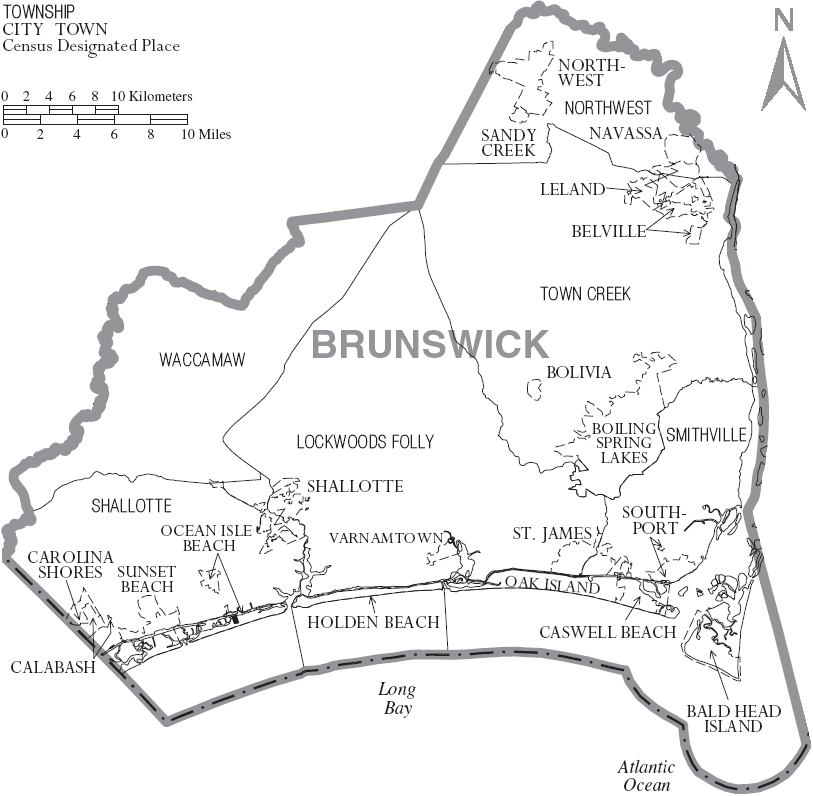
Map of Brunswick County, North Carolina, United States with township and municipal boundaries |
|---|---|
| Source |
taken from US Census website [1] and modified by User:Ruhrfisch |
| Date |
June 2007 |
| Author |
US Census, Ruhrfisch |
| Permission (Reusing this image) |
US Census / US Government work is public domain, my modifications licensed under the GNU Free Documentation License |
| Other versions | none known |
[edit] Licensing
|

and
| This image or other media is a work of a United States Census Bureau employee, taken or made during the course of an employee's official duties. As a work of the U.S. federal government, the image is in the public domain |  |
Historique du fichier
Cliquer sur une date et une heure pour voir le fichier tel qu’il était à ce moment-là
| Date et heure | Dimensions | Utilisateur | Commentaire | |
|---|---|---|---|---|
| actuel | 2 juillet 2007 à 05:44 | 813×796 (98 Kio) | Ruhrfisch | ({{Information |Description= Map of Brunswick County, North Carolina, United States with township and municipal boundaries |Source= taken from US Census website [http://www2.census.gov/geo/maps/general_ref/cousub_outline/cen2k_pgsz/nc_cosub.pdf] and modifi) |
Pages contenant l’image
La page ci-dessous contient cette image :

