Image:Map RiviereDesRemparts.jpg
Un article de Wikipédia, l'encyclopédie libre.
Taille de cet aperçu : 701 × 599 pixels
Image en plus haute résolution (3 047 × 2 605 pixels, taille du fichier : 1,28 Mio, type MIME : image/jpeg)
| | Ce fichier provient de Wikimedia Commons?. Les informations le concernant sont affichées ci-dessous (procédure). |
[edit] Summary
| Description |
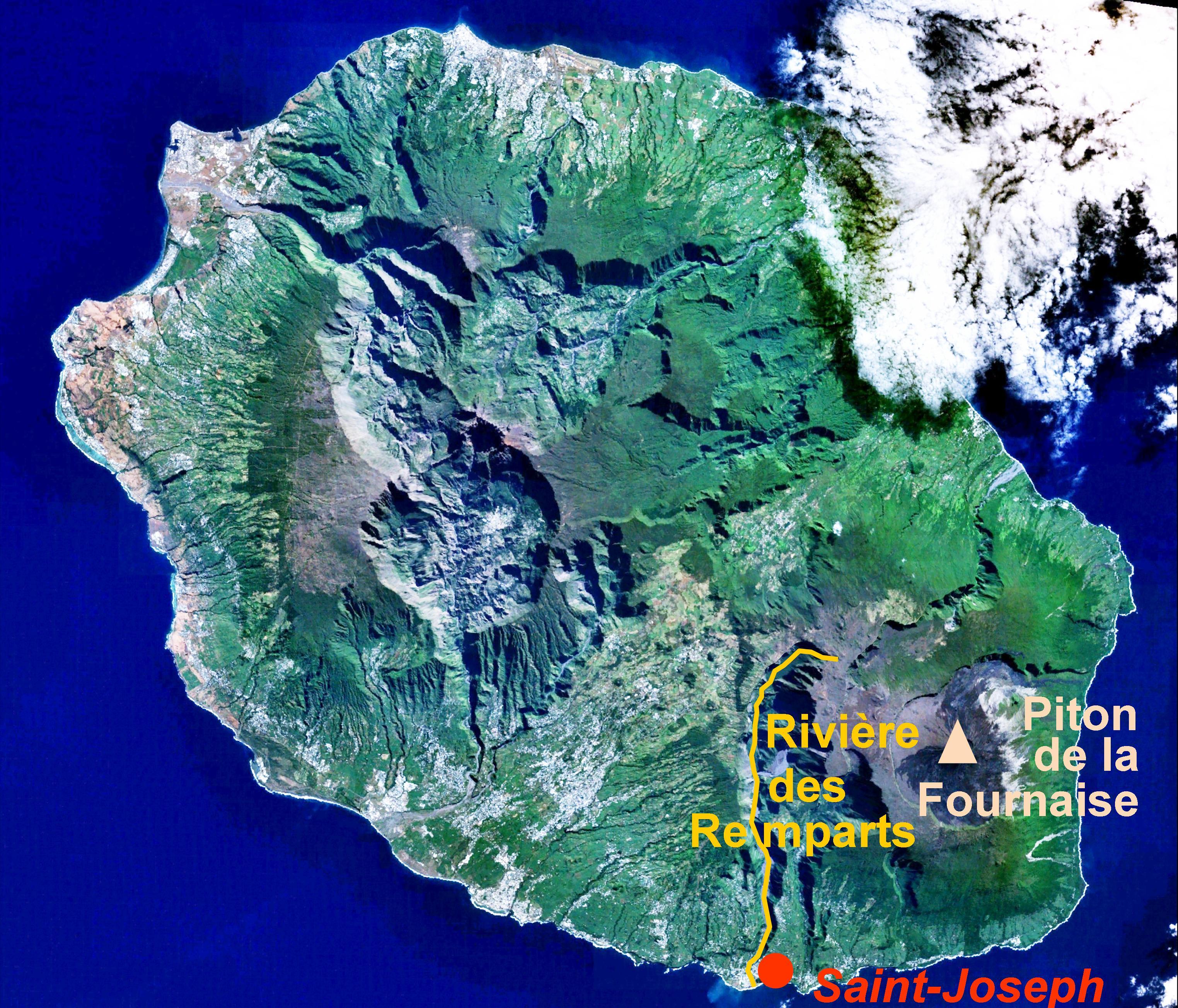
location of the Rivière des Remparts on a satellite view of Réunion island |
|---|---|
| Source |
caption added to Image:Reunion 21.12S 55.51E.jpg |
| Date |
caption added by User:B.navez on 24 JUN 2006 |
| Author |
NASA |
| Permission (Reusing this image) |
PD |
[edit] Licensing
|
|
This file is in the public domain because it was created by NASA. NASA copyright policy states that "NASA material is not protected by copyright unless noted". (NASA copyright policy page or JPL Image Use Policy).
Deutsch | English | Español | Français | Nederlands | Português | Русский | 中文(简体) | 中文(繁體) | +/- |
|
 |
Warnings:
|
Historique du fichier
Cliquer sur une date et une heure pour voir le fichier tel qu’il était à ce moment-là
| Date et heure | Dimensions | Utilisateur | Commentaire | |
|---|---|---|---|---|
| actuel | 24 juin 2006 à 13:40 | 3 047×2 605 (1,28 Mio) | B.navez | (the same picture without black strips) |
| 24 juin 2006 à 13:30 | 3 072×2 622 (1,29 Mio) | B.navez | ({{Information| |Description= location of the ''Rivière des Remparts'' on a satellite view of Réunion island |Source= caption added to Image:Reunion 21.12S 55.51E.jpg |Date= caption added by User:B.navez on 24 JUN 2006 |Author= NASA |Permission=) |
Pages contenant l’image
La page ci-dessous contient cette image :

